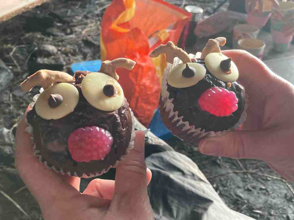
I was out today with a small explorer group from the island, having been enticed by the title “Caves, Cakes, Coffee and Reindeer” walk or something like that. Don’t get ahead of yourself, we have no reindeer on the island; our host had very ably made some buns to resemble reindeer, it almost being Christmas, and very successful they were too.
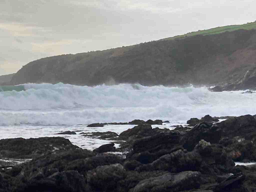
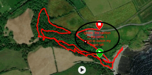
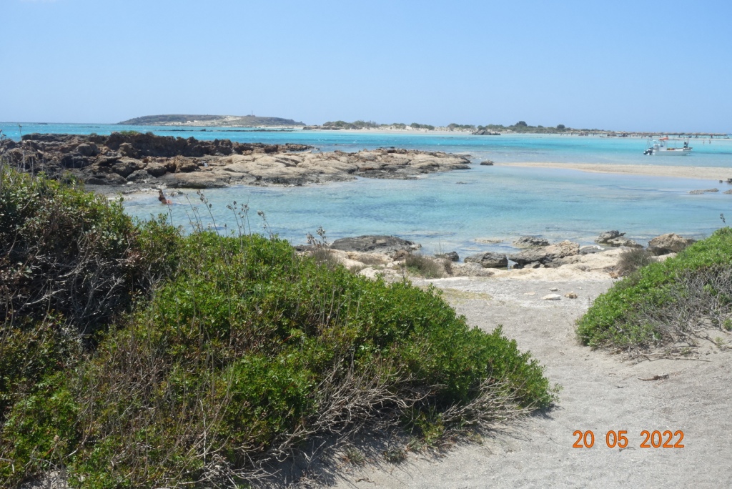
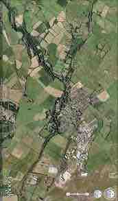
I can’t tell you too much about this walk as our host, Andy, wants to keep his ‘secret places’ secret for others to explore and to this end, the hidden places should remain hidden. However, it is no secret to say that we parked at Kallow Point in Port St Mary on an extremely blowy day to start our walk. When we arrived, it looked as if it was already high tide as the waves were crashing about the shore, but high tide would still be a few hours away.
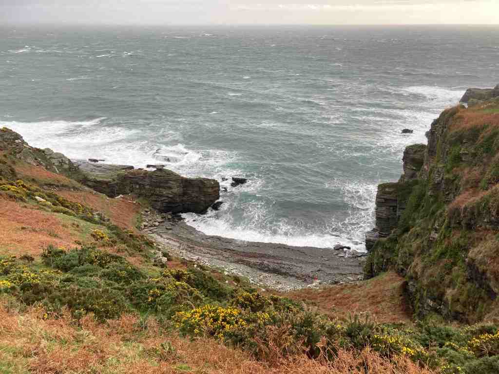
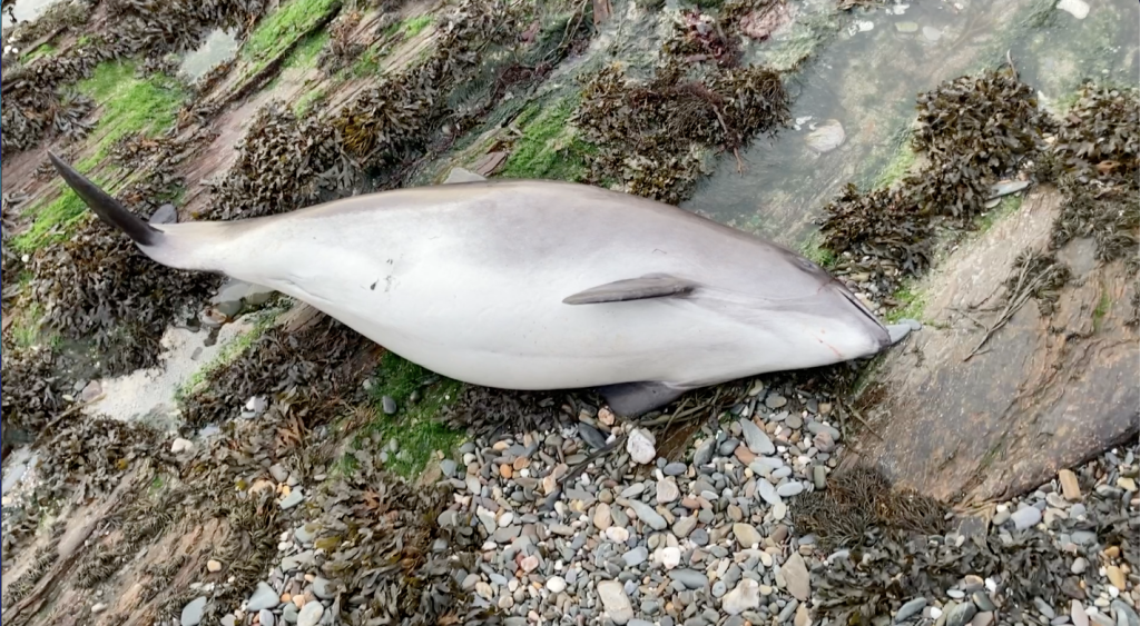
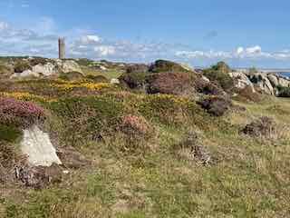
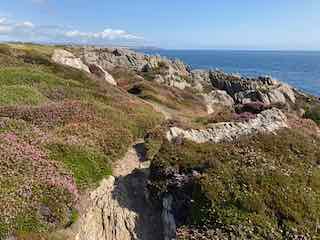
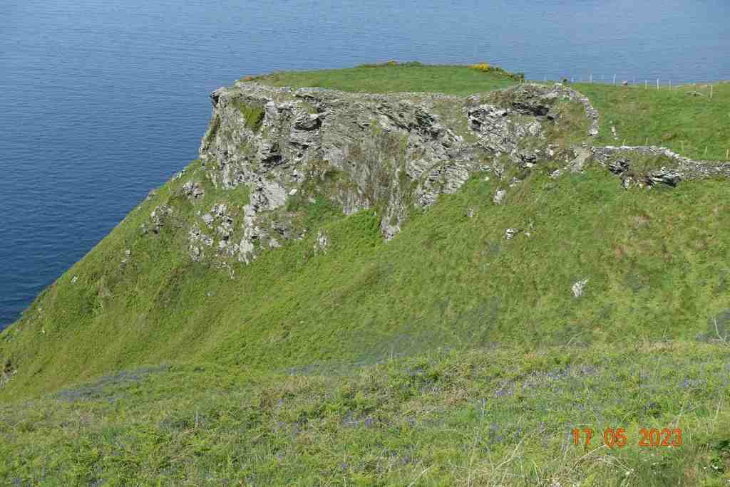
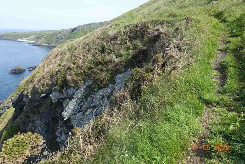
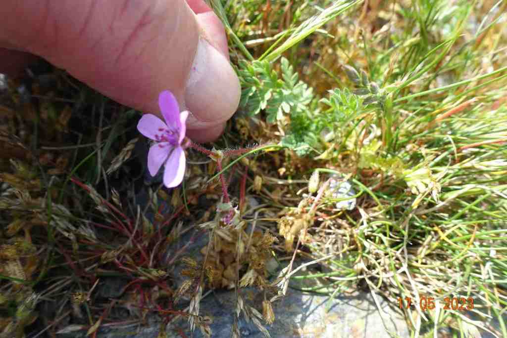
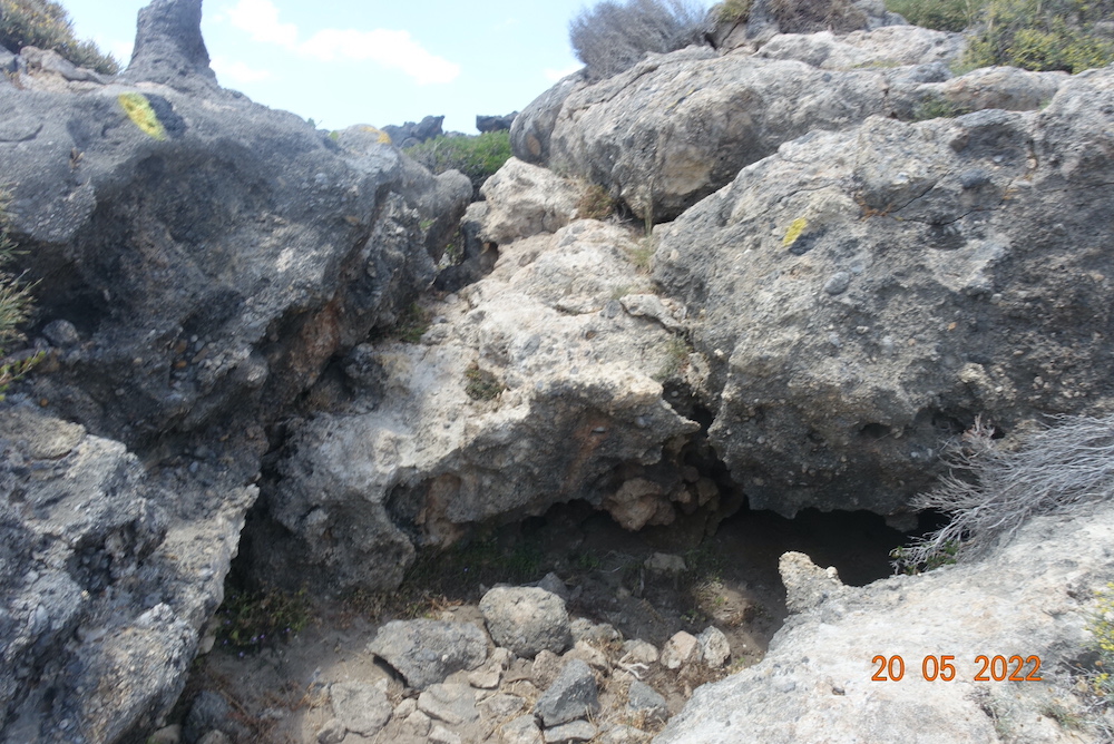
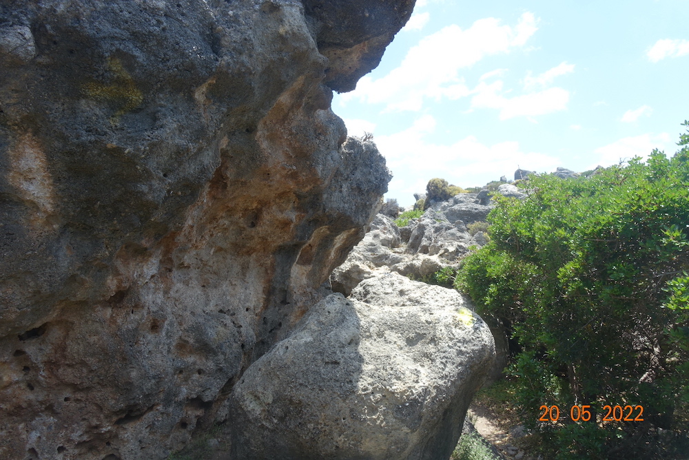
We walked towards Perwick and along the shore, scrambling over rocks where necessary and where we encountered a stranded and decidely dead Porpoise, having got beached in the massive overnight tides. It otherwise looked healthy, but the rocks round here can be treacherous as you can see in the photos. I won’t be giving too much away by saying that there are a few caves along this stretch of the coast, but you won’t find them unless you do a bit of adventuring. Similarly, there are some hidden beaches, and again, you won’t find them by sticking to the coast path. Unfortunately, the weather was just too windy to risk going down to some of the secluded beaches, which would have required fairly steep and rocky descents whilst fighting offshore winds, so we satisfied ourselves with knowing where they are for another time.
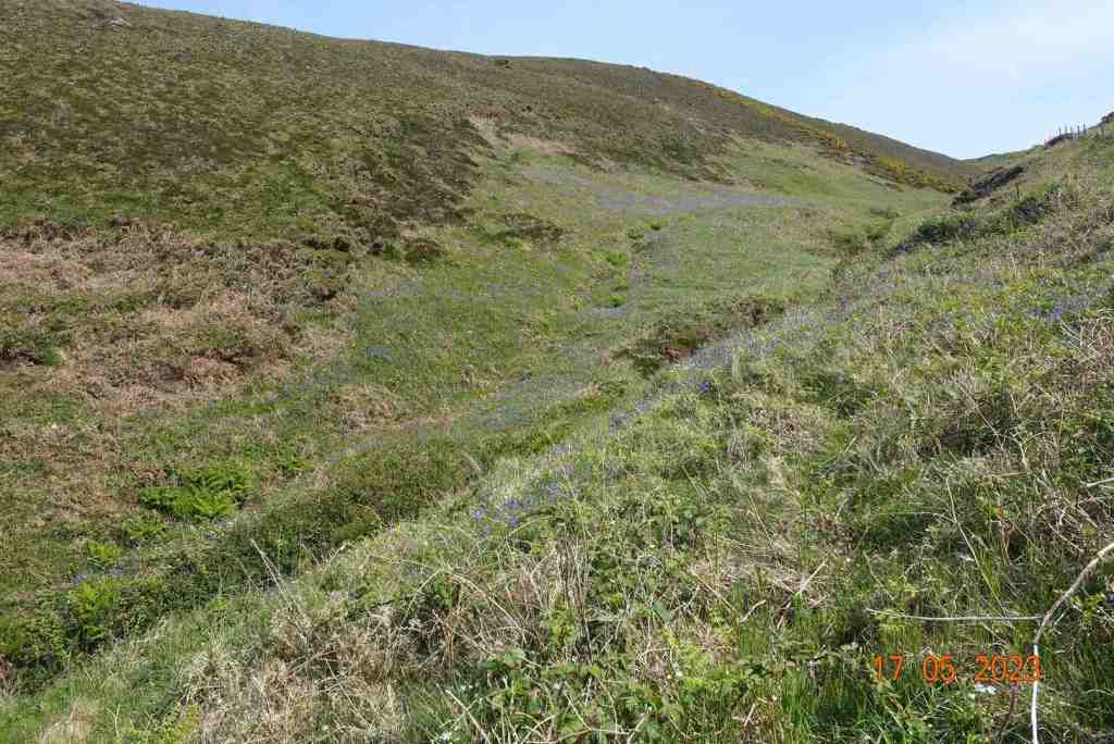
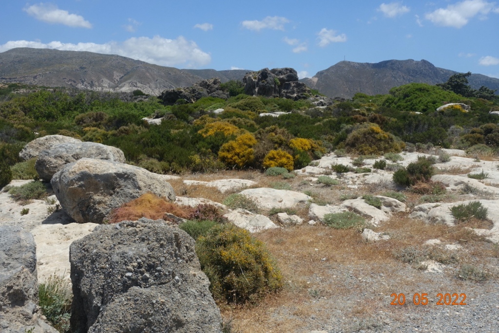
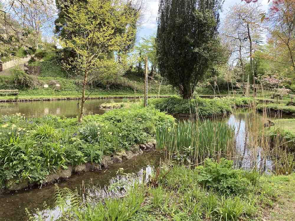
Our host was very knowledgeable and pointed out different types of rock, provided us not only with cakes and coffee but scavenged sea spinach from the cliffs encouraging us to taste a morsel of this salty herb. There was plenty of sea glass amongst the pebbles that interested some and some fascinating patterns in the stones, one in the shape of a cross on all sides. He told us about a hidden lake, so hidden that it is impossible to find unless you have a boat, so please don’t go looking for that! If you fancy a walk with a difference, they have a website and a FB page with details of forthcoming outings: https://www.facebook.com/happyexploreriom/
To finish, here are a few photos, none which should give away too much 🙂
It seems a long time since I posted here! I don’t know what it’s been like where you live, but we seem to have had constant rain since July here on the Isle of Man, with only brief respites in between deluges. When we do have nice days, and they do occur sometimes, I am usually busy working. So, it was a delight to get out and up to Ramsey to do a recce of a very short morning route I am leading in 10 days.
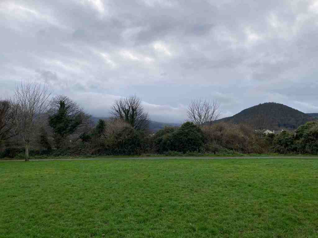
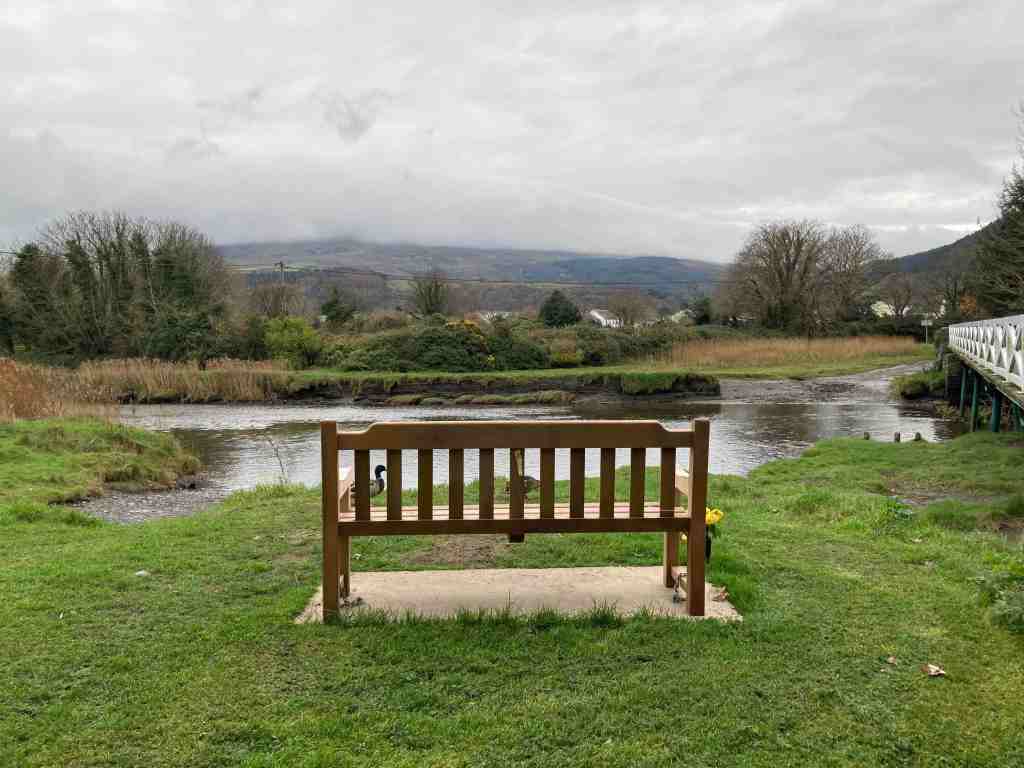
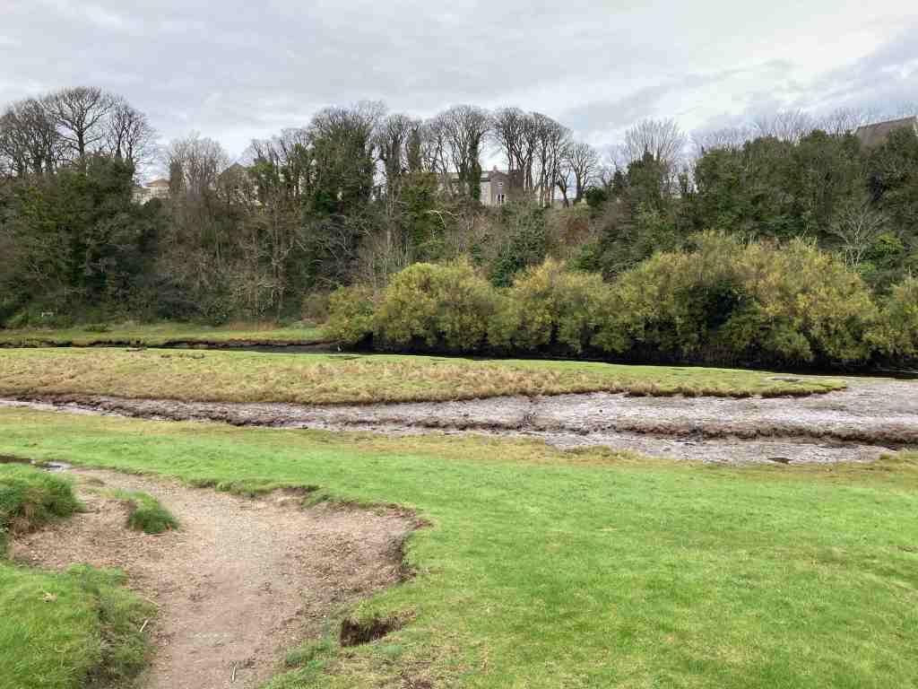
This 2 mile stroll is our build-up for our U3A Walking Group’s Christmas meal. We are having an afternoon walk later after our slap-up meal. Indeed, this will be my last walk for the U3A as leader and organiser of this group as I have decided to stand down. Parking at Milntown, it is easy to cross over the road and walk down Gardener’s Lane before turning onto the old railway track and heading east towards Ramsey. In the past, this must have been an attractive stroll, but the first half of it goes between newly constructed houses, and it is only when it reaches the outskirts of Poyll Dooey that the old track regains nature on either side of the path. The walk starts at the very end of the track, where it joins a road where you can see the river on the left. The views of the river are beautiful in both directions. It is a tidal river, constantly bringing crustaceans and worms into the mudflats that are exposed at low tide. The mudflats then turn into a salt marsh, an unique specialised environment that allows grasses and herbs to grow that cannot grow elsewhere. This in turn encourages a variety of wildlife that can feed off this specialised turf and soils. It is also beautiful, and unexpected being so close to the town.
There is a variety of paths through the Nature Reserve, which is a recent creation. It was formerly an old tip, as recently as 1988. It just shows what can be done with a bit of imagination and dedication. It is a small area of only 12 acres but it packs plenty into it. The woodland is still quite scrubby, with the exception of the Secret Garden area that has been specifically planted with a variety of trees. Some parts are protected and therefore inaccessible; imagine, if you were to come back in 50 years I think this will be a very special place.
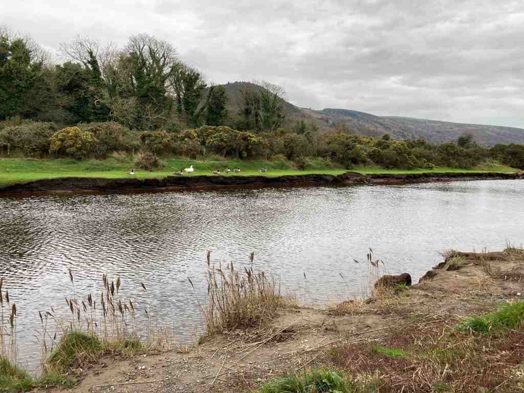
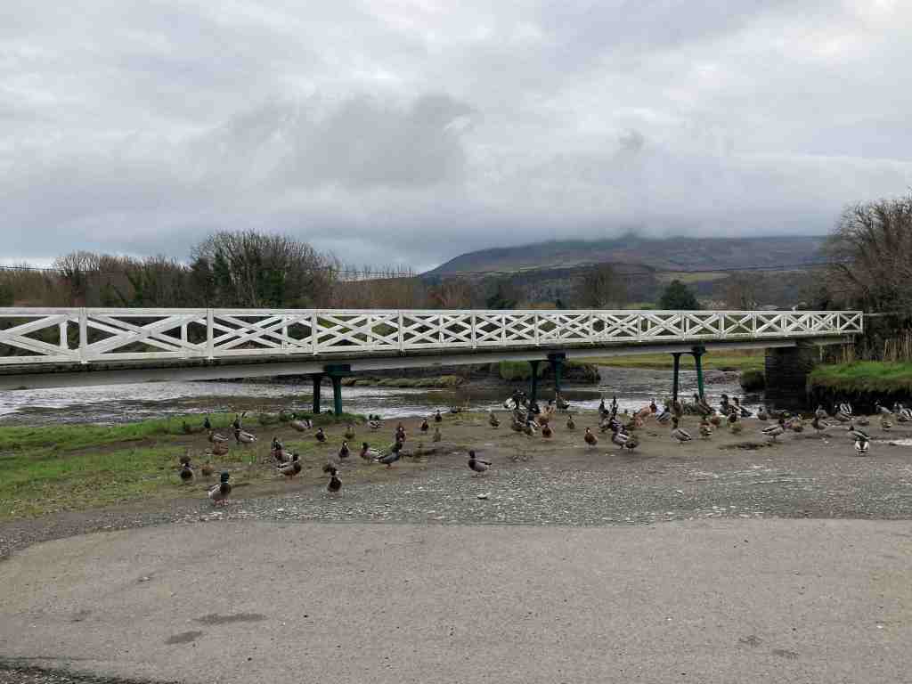
I followed narrow footpaths over the salt marsh so that I could follow the river as much as possible. Please try and avoid walking all over it and keep to the side as much as possible. Dogs are allowed, but better not to let them dig up the area. There is plenty of room for them to be off the leash in the woods themselves. It is not long before it is necessary to go into the woods and you will find yourself at the wooden footbridge, where there is usually a mass of ducks, geese, swans and the like. Today, they sounded just like a load of girls giggling in the playground. They were very funny. In the sheltered areas, especially in winter, you may be lucky enough to spot a kingfisher, a species which is declining on the Isle of Man, so if you do see one, please let the Bird Club know.
Crossing over the bridge you can walk a short distance westwards to admire the river and distant views; the river may contain trout and salmon as well as all the bird life. Further along is a mass of reeds, where I imagine birds nest or gather material for nests. It is not possible to go further in this direction but it is still worth a look before retracing your steps over the bridge.
It is possible to take a different route back to the start through the woods, going past the impressive 6 bedroomed Poyll Dooey House. This is entirely surrounded and hidden by the nature reserve, and part of the house goes back to the 17th century. If you do an online search you will find photos of the interior and exterior on the deanwood.im website. How the other half live… These buildings comprised one of the original quarterland farmhouses – a quarterland being a unit of farmland, usually arable land. Its boundaries would have extended all the way to the Ramsey to Ballaugh road in ages past.
From here, it is simply a matter of following any path; you cannot go wrong. They all take you back to the railway track one way or another. It is worth visiting this area during the different seasons and noting down what different birds you see and hear, and perhaps bring a picnic in the summer months. And don’t forget to visit Milntown itself – the house and gardens are open most of the year and they serve great lunches and afternoon teas, and the gardens are a delight.
You know how writers and walkers all say that no two days are the same at the same location, well this is certainly true of this walk. Last week I was here with my grand-daughter, Emily, and the tide was satisfyingly in; yesterday, the tide was interestingly out, carving out a completely different landscape.
I was doing a recce for a walk from Castletown. If this is a walk you are planning to do, don’t take your car into the main streets and car parks of Castletown as there is only 2 hr parking. Instead, take the road to Derbyhaven and park either along the prom, or in one of the free car parks on just the other side of Hango Hill (above), opposite King William’s College. I had taken the train, so was walking from the station. However, I would recommend this walk to start at the first car park after Hango Hill. It is only a short distance back to explore this ancient monument before retracing your steps to start the walk.
As you can see from the photographs, if the tide is out, you can walk along the beach. Even so, there is a grassy footpath from the car park which is good to follow. It bypasses Derbyhaven and the start of the golf course, making a more interesting start to the walk. There are a few pebbles on the path as these are constantly thrown up by the sea, but it is easy walking. Eventually you reach the small lane and you are obliged to walk along this most of its way, but no more than half a mile or so. It is very quiet and there is lots of vegetation, birds and butterflies to look out for. You will pass the stone bird water trough commemorating one of the island’s principal ornithologists and you will very likely see Egrets or Herons perching on the rocks around here.
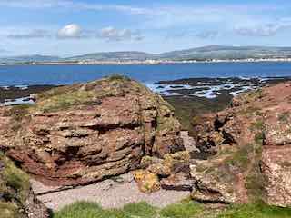
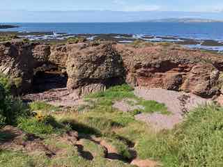
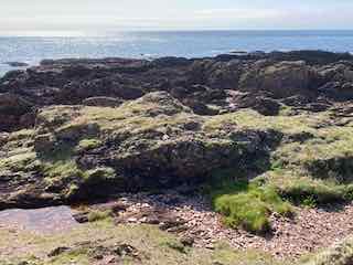
A little further along is the main car park for Langness and it is here where you enter the reserve itself, the paths taking you round the very tip of Langness. To your right, you will see strange rocks of conglomerate, arches looking as if they will collapse at any moment and notice areas of unconformity where millenia of rocks have miraculously disappeared. I am no geologist, but this area is described in many of our local books if you wish to find out more. If you are feeling adventurous you can scramble about on the rocks to the west as they dip and turn, but take care, not just of your footing, but make sure that you don’t get cut off by the tide, unless you want to join the shags and cormorants on the very last morsel of rock remaining at high tide!
Tide inTide outFun on the rocks
The path takes you around the lighthouse, where you can take a look at the old foghorn. This is the most southerly point on Langness. It is a good stopping point for lunch, which is exactly what I did yesterday. As I sat muching away I heard the lamenting sound of a seal and got out my opera glasses (yes I know, proper binoculars would be so much better, but these fit into a side pocket). There they were, some lumbering about on the rocks, others swimming in the sea. As I continued on the eastern side of Langness there were even more seals. They do seem very big this year.
Most southerly pointLangness LighthouseHerring Tower
The eastern side has a different feel to the western side. The terrain is soft underfoot with more varied rocks landward and more gullies with sharp upright rocks on the seaward side. There is gorse and heather setting off the herring tower, and as you walk the mile or so towards the golf clubhouse you get amazing views of the range of hills all the way from Bradda Head to North Barrule. The path eventually goes onto the golf course itself, so keep towards the edge. There is plenty of room to walk beside the course rather than on it. However, to get to the clubhouse you do need to cross it for about 50 yards, so watch out for flying balls.
The golf club welcome visitors and the food is always tremendous so don’t be shy about calling in. The rest of the walk takes you around the glorious bay of Derbyhaven and then back along the road for about half a mile to the car park. There are few places like this on our island, and I thoroughly recommend it for a morning walk, a lunchtime walk, or an afternoon walk. Keep in mind, it can be very blowy as it is mostly flat with just a few humps and hollows. You will also be walking in a southerly direction so the sun can be a problem on the odd occasion it shows itself.
The total length of the walk from the Hango Hill car park is about 5 miles.
What a way to refresh your soul. I have been working flat-out for a few weeks now and had set aside today for a complete day to myself, without any students, without looking at emails or marking work. I had not anticipated such as treat as I started off through Kerroodhoo Plantation, having parked off the road at Dalby Mountain Nature Reserve.
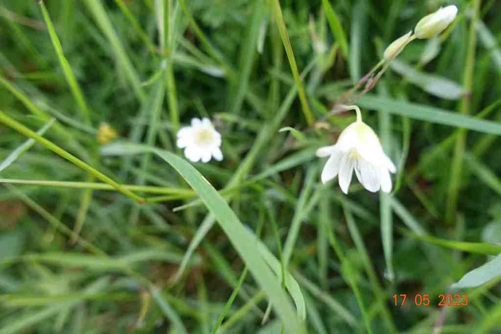
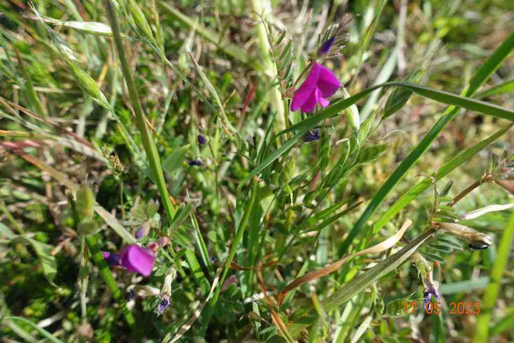
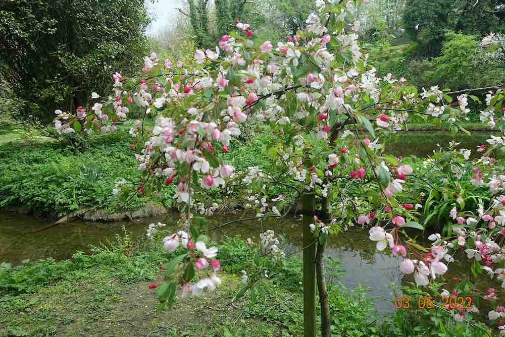
The sun was shining and it was a warm day as I ventured into the eastern edge of the forest. It is always a delightful walk, no matter what time of year, but as the sun glinted through the trees, it was very pretty; even more so when, rather like Wordsworth daffodils, I came across a sudden drift of bluebells, that went on in all directions. I took photo after photo but show you just two here. Although the path is only partly marked out on the map, in practice it continues all the way to Barrane. In places it is a little muddy and in other places slightly steep. If you are slightly infirm of foot I would definitely use a pole to help you down safely, but these are very short sections and nothing to worry about. Not only was there an abundance of bluebells, but throughout this walk there were many, many different wild flowers and it was pure joy to be amongst them. I shall include a slideshow of these at the end.
Barrane appears after a mile of walking downhill, then the route joins the road leading to Dalby but go south instead of north, and this becomes a stony track uphill. After crossing the ford, or avoiding it by following the signs for the coastal footpath, take the footpath that leads to the edge of the coast. Most people turn right to go to Niarbyl, but our route goes south at this junction and the cliff path is delightful along here. There is a little uphill walking at this stage but there is a nice resting place where I stopped for some time watching the tortoiseshell butterflies doing a merry dance and listening to the linnets singing in the bushes. The view was sensational and there were different flowers in every direction that I looked. It was so restful and just what I needed.
From here, there is a little more uphill and then you join the standard coastal path which begins on a fairly level grassy path before zigzagging downhill for a short distance. Having crossed the ladder stile, the path becomes narrower and closer to the cliff edge. It is never dangerous, but I know some people get nervous on such paths so I have included some photos to show you how close it is. As I say, it is perfectly safe. After a little more downhill, where you are fairly close to the bottom of the cliff at 153ft above sea level, we cross a stream called Glion Mooar and then start the rather more cumbersome 500 ft / 3/4 mile climb up to Eary Cushlin house, of which the first part is the steepest. This can only be avoided by not taking the coastal footpath earlier, but it is a good, grassy path and you can rest whenever you like.
I plan to lead this walk in August, but from here I shall probably take a slightly different route to avoid walking on tracks. Today, I followed the main track up to the edge of the plantation then turned south. This goes very gently uphill to the highest point of day at 998ft. The route then turns off into the Dalby Nature Reserve owned by Manx Wildlife Trust and we walk through this back to the cars. This is likely to be boggy in places as it was today, so if you do follow this route I would recommend wearing long trousers and gaiters. Gaiters for the boggy bits and being a nature reserve the heather and gorse do not take account of walkers and sometimes the path is very narrow if existing at all.
I am feeling so much better these last few weeks and I hoping to get out in the countryside once a week from now on, so you can look forward to a few more posts over the coming months than I have been able to write in recent months.
It was a lovely sunny afternoon on Saturday and what better way to get some gentle exercise than to stroll up the small but beautiful glen that is Port Soderick Glen. You really don’t need to set any time aside for this walk as it will only take you 3/4 hr even if you are walking at a leisurely pace. It has a timeless tranquillity about it, and possibly because it is only half a mile long you can imagine all the feet that have traipsed beside the stream as you jump over the boggy bits and admire the hills on either side.
I was really on my way to Tesco in Douglas. This is what is so nice about the Isle of Man. I could have done a number of different short walks along other glens on the way, driving through lovely countryside to get there. This had to be a short walk as I was still suffering with a fair amount of pain but I needed to build up my exercise after 5 weeks. The first thing that struck me was the bird song – not that I can recognise birds from their song but I enjoy trying to find out where they are perching in the trees while they perform their arias. The second thing I noticed was that it was quite wet and there was a fair amount of water in this little stream. The third thing I noticed was that the paths have been upgraded and a new higher path has emerged. Of course, I had to try this out. As I reached the ‘top’ there was water gushing off the meadow above. It had created a small path in the grassy turf before it tumbled into the glen, but where was all this water coming from? It was only a few feet to the top from there, maybe 8-10 ft, so how was it generating that kind of force? It’s good to have mysteries – just as we have our faeries and elves on the Isle of Man.
There is little to say about the walk itself. I walked one side of the stream, admiring the celandine and wood sorrel; then as I crossed to the other side there were primroses and marsh marigolds and a few stray daffodils enjoying the sun. You reach the end of the glen where it joins a track and there is a quaint bridge to the left. Follow the track to the right and it will join the road – here there is a minor tributary than joins the Crogga River that you can just about make out in the vegetation below, and there are plenty of trees as you make your way upwards. At the road, it is necessary to walk a short distance back along the road towards the sea, but then it is possible to turn back into the woodland and rejoin the river near the bridge. It feels completely different up here, with less vegetation and the trees standing tall. It is a very well made path and pleasant to walk along.
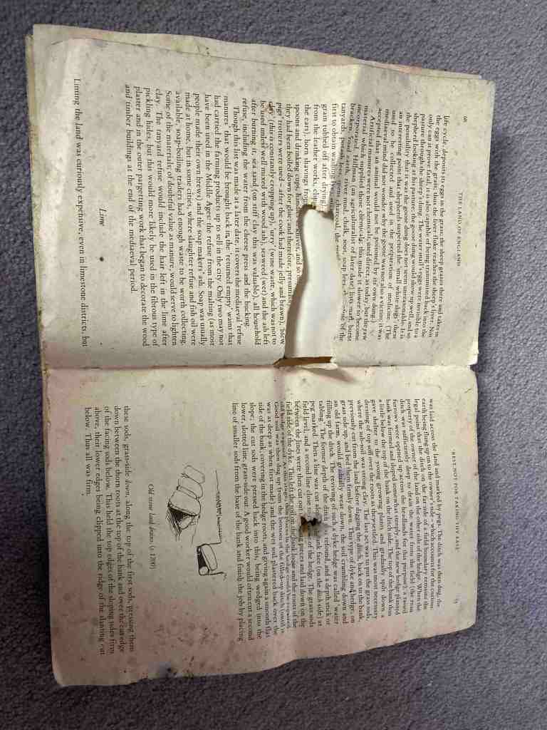
I had just joined the forest track when I spotted something on the ground, that looked like pages from a book. Indeed, this is exactly what they were. What an odd place to find such a thing. The pages were from a very old-looking book “The Land of England” and covers what happens to the land in each month. There were only a few tattered pages and they just happened to be for March, telling me how a furrow-slice works and how to gather up the ridges; also a quote from an ancient scribe on how to keep oxen. It even told me the origins of the word ‘camping’ which has absolutely nothing to do with putting up a tent in a field….
What goes up must go down, and the path down eventually ends in very nicely constructed steps, not too steep and quite manageable. From here, there is no choice but to follow the stream back to (the car park) or the sea. I had a wonderful surprise when I glanced up and saw a falcon displaying it aerial talents over the top of the trees. After this brief respite, I continued my journey. The sea hits you as something of a surprise as if you park in the lower car park and walk up the glen you wouldn’t know the sea is just to the left and only yards in front of you. And what a view when you get there. I was delighted as the tide was well in and the waves crashing on the pebbles. The beach itself is not amazing and it is a bit scruffy but I believe there are plans to do the area up a bit and restore it to its former glory.
If you want a little more of a walk, continue along the edge of the beach to the steps that lead up the northern edge of the cliff. This is an attractive addition to the walk. You can go all the way to Douglas if you really want to, along Marine Drive, but that would take you a couple of hours. However, if you time it right you can get the steam train in one direction of the other to make it a linear route. Otherwise, when you have had enough, just turn round and retrace your steps back to the car.
I confess I am still sore after my operation, and it is making me feel unwell, but I had my post op appointment yesterday and the Consultant (Mrs. Moroney) was just wonderful and reassured me that my recovery is as it should be. My operation was bigger than we were all expecting so I couldn’t expect to be in any better condition than I am right now. However, she says the chances are that I will be fighting fit again for the May walk and she said that it is often the case that just one day the patient wakes up and feels well again and there is no looking back. So I remain optimistic.
I shall be joining the U3A walk on Tuesday from Castletown to Port St Mary, but just for part of it. It will be nice to see everyone again and for life to return to some semblance of normality. This weekend I plan to do a recce for the walk I shall be leading in May, so let’s hope for some good weather.
This is a delightful short walk providing extensive views to the north of the island. On a good day you will see Scotland, the Lake District and Wales, and all just a stone’s throw from Ramsey.
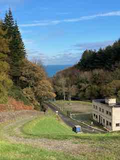
The walk began at the Gooseneck car park on the Mountain Road. There is a grassy footpath leading upwards beside the main road but away from it, so it is safe to walk the short distance to the bend in the road, when we turned left onto the Hibernian road. At this junction a new bench has been placed to commemorate a couple who both died of covid within weeks of each other – a very sad memorial. The bench is beautifully made and the views towards Ramsey are unsurpassable. This is a viewing point for the TT, being between the 25th and 26th milestone and is 550ft above sea level.
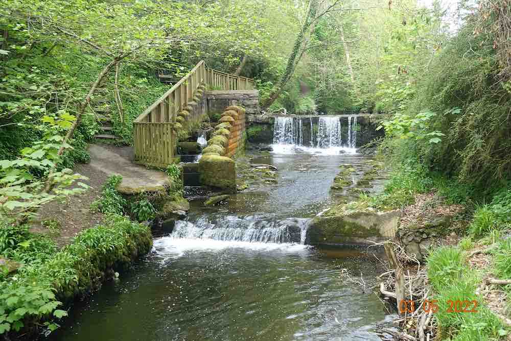
We passed by the top end of the Ballure plantation before turning into it to follow a delightful track, made even better by the dappled sunlight sparkling on the trees. There has been a lot of rain lately and we had a small flurry of light rain for a short time, just to give some variety. As you walk through the plantation you can hear the stream rumbling away in the distance. One and a half miles into the walk and we find ourselves at the Ballure Reservoir. This was originally created by Ramsey Waterworks in 1884, collecting water from Druidale to Ballure for the merry folks of Ramsey. There were in fact two reservoirs slightly lower than the existing one. The current Water Treatment works was constructed in the 1950’s and the new dam created over a valley of glacial deposits on top of the bedrock. The embankment is 17 metres high. The reservoir itself is is 11.5m at its deepest point, contains 18 million gallons of water, providing 3.5 acres of fishing, mostly rainbow trout and the occasional incomer of brown trout. In summer you are allowed to catch 4 fish in summer, and 2 in winter, all by licence of course.
The actual Ballure (Place of the Yew) plantation is relatively new and was constructed in the 1960s and covers 30 hectares. There were people on our walk today who could remember there being few trees, just a few old gnarled ones. In the mid 1990’s it was completely restocked with broadleaf trees, which we are all benefiting from today. It is a delightful walk through the lower part of the glen. Taking the upper path close to the road you can imagine that this would have been the original Moutain Road before the super-route was developed sometime after 1866. Prior to this the mountain road barely existed, just feeding small, isolated farmsteads. Then the government got involved to decide whether this was private land or ‘crown’ land. Various parts were sold off and £25,000 (a fortune in those days) was raised to develop the road across the mountain.
We reach the Hairpin bend and cross over the road. There was a lot of water in the small waterfall at the corner, something I have never noticed before, and our leader said that often there is very little water there, but of course it has done nothing but rain for several weeks on and off. We continued through the Claughbane plantation, which was originally a commercial plantation but has more variety now and a range of activities go on here, courtesy of The Manx Wildlife Trust. They are currently developing some natural playgrounds for children there. At the bottom end the beech trees looked wonderful in their autumn glory, but they do deplete the vegetation on their leafstrewn banks.
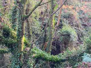
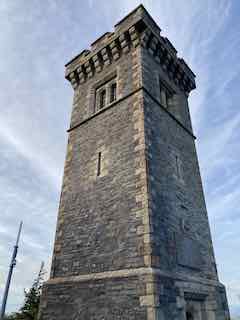
It is just a hop and a skip then into Elfin Glen, so named to incite the imagination of tourists. It’s original name was Ballacowle Glen. While I remember, for those who participated in this walk and wanted to know the translation of ‘Cooil”, it means ‘winding nook’. Elfin Glen does not contain a wide variety of trees, being mostly, oak ash and hazel. There is also evidence of pedunculate oaks. This Glen was purchased in 1963 by the Forestry Board for £3625. It is a steep sided glen and you can wander freely through it and it does have quite an eerie feel to it. It is very quiet and unspoilt with a very small stream running through it deep below the path. At its furthest point, you cross over a bridge where there is a small waterfall. Crossing over to the other side, we come out of the glen to reach our final viewpoint of the day – the Albert Tower, visible for some distance as your traverse the Mountain Road or descend North Barrule.
This is located at the top of Lhergy Frissel – don’t we have wonderful names? Lhergy means a hill slope or a high wasteland, both of which apply here. This folly was created to commemorate a visit of Prince Albert, who surprised everyone by rowing from his boat into Ballure rather than Ramsey and taking a walk up to this place on 20th September 1847. Who knows what inspired him, but if this story interests you, you can read more about it here:
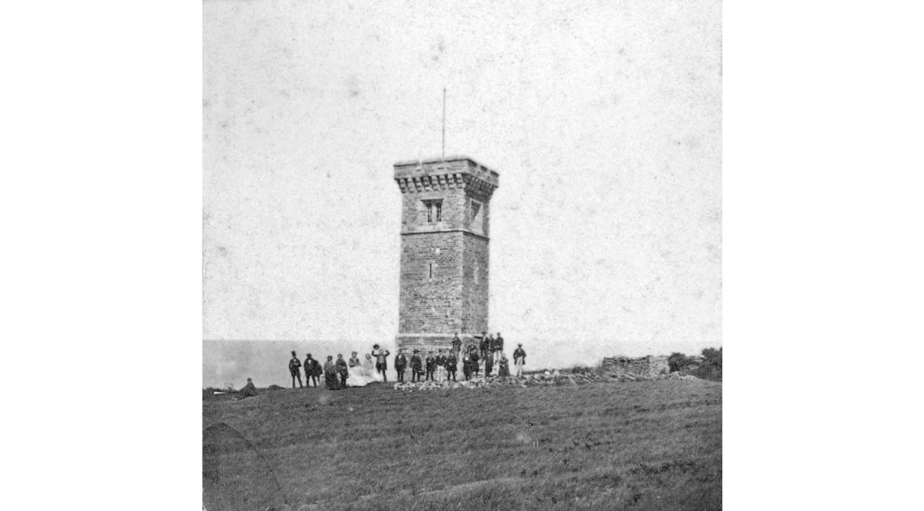
The tower is built of granite and marble blue slate. It is an impressive construction, 45 ft high (14 m) on top of a hillside (Albert Mount) 430ft above sea level. It cost £300 to build. It became a registered building in 2003. You cannot go inside as I believe the staircase is in a state of disrepair. It was used in WW2 as a look-out by the Home Guard. The old photo above is courtesy of the i-museum.
From here, it is a short trip across fields back to the car park. If you just want to visit this, it takes no more than 5 -10 mins to walk to it. The total walk is just over 4 miles with a maximum of 800 ft of ascent; there are few steep areas, just a lot of ups and downs adding to the total ascent. Thank you for Dulcie for leading it for the IOM U3A. It was most delightful and so nice to visit hidden spots and see the sights at a different time of year too.
This trip was planned to allow me to test out my feet, both for driving and for walking. As it turns out I did more of the former than the latter, and I guess my left foot in particular will not be too keen on long walks right now. Driving was better, my main injury being my left ankle so not too much required on this foot except for gear changes. Even so, the 2 hrs in the car, and the 1.5 mile walk was quite enough for one day. As I have to drive in England before too long, I was testing the water.
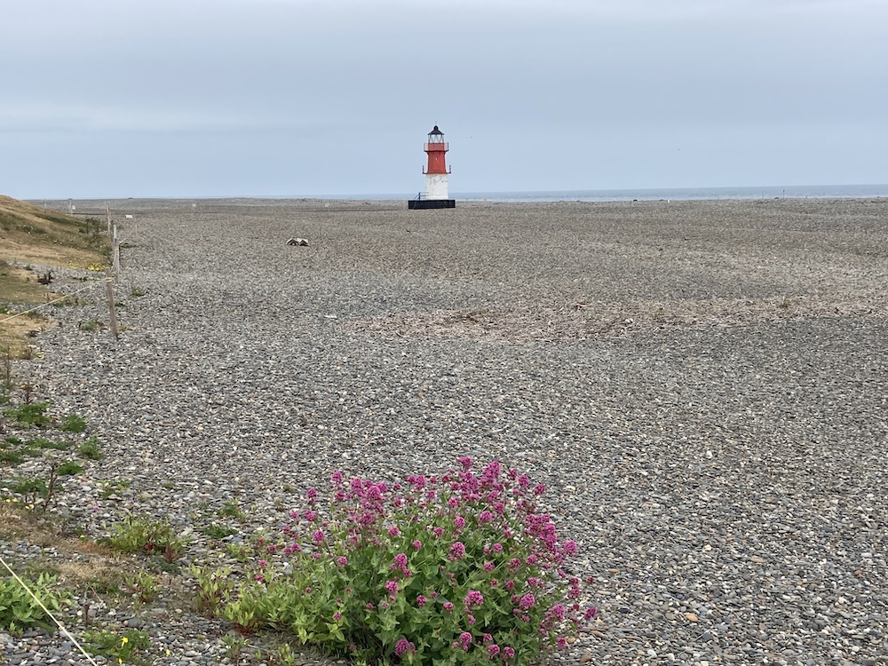
It was a dull and cloudy day, promising to rain. Believe it or not, I have never walked around the Point of Ayre towards Cranstal & The Dog Mills down to Ramsey, only walking along the most ‘northerly’ part of the island previously towards the Visitor Centre. It isn’t really due north, as the island lies on an angle, but technically this is the most northerly point on the island. I took this photo off my tv having recorded a programme about Earth from Space, and it conveniently gave this interesting view showing the true location of the Isle of Man.
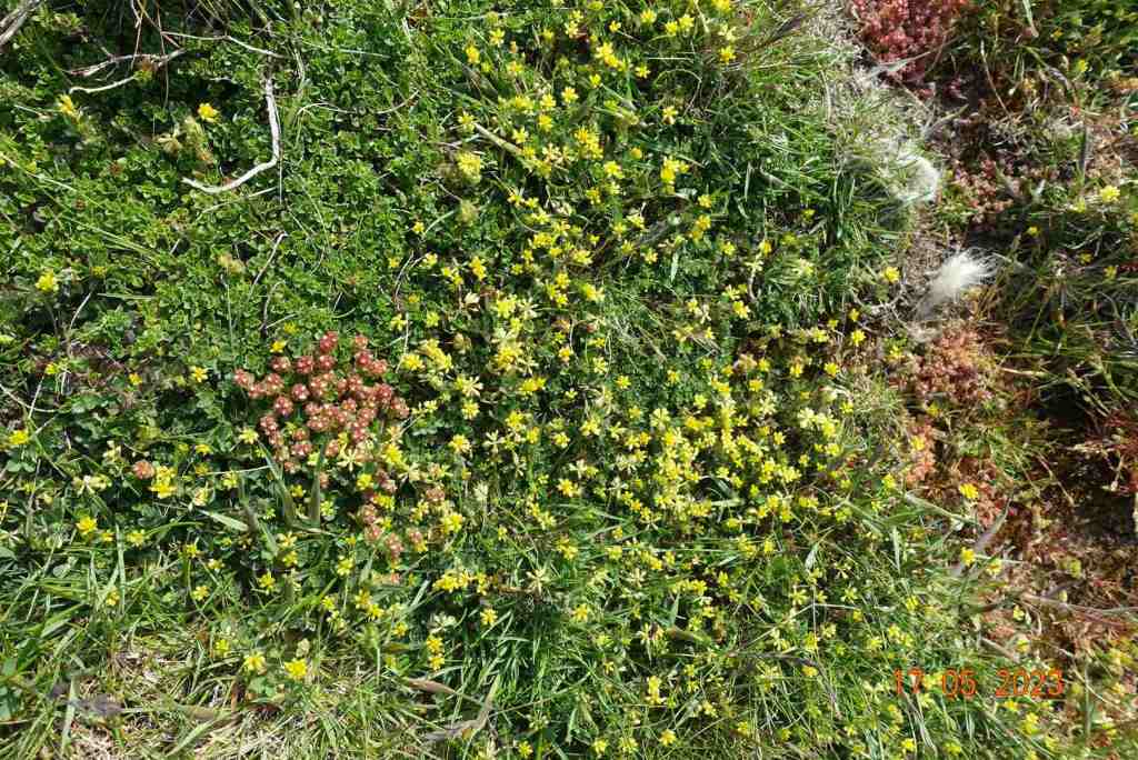
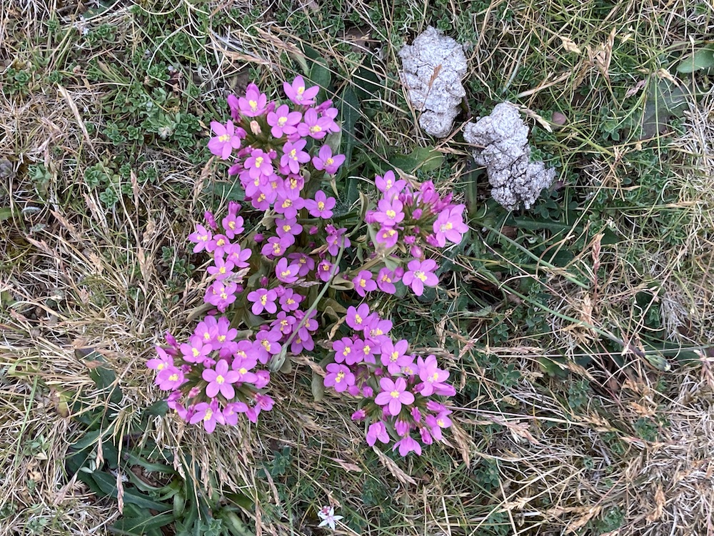
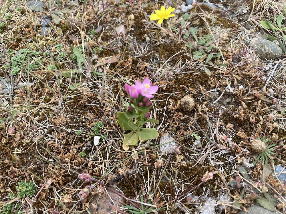
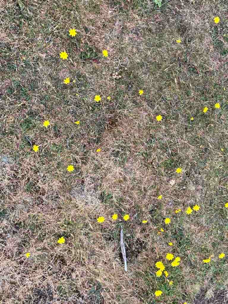
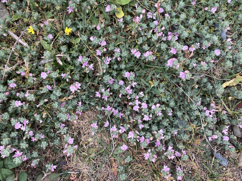
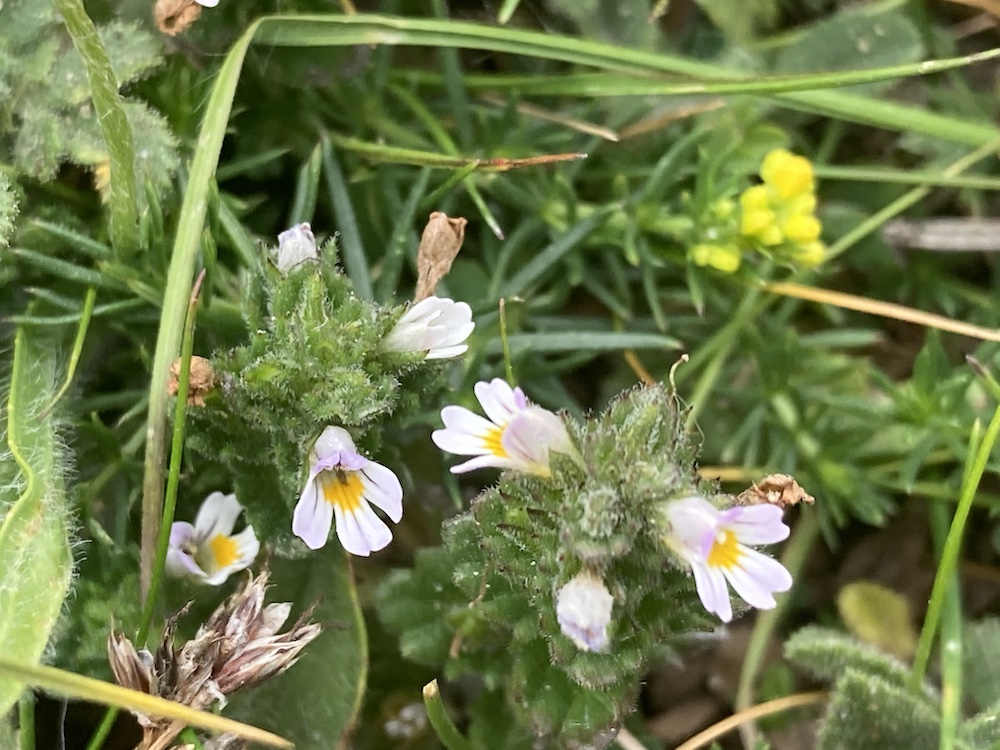
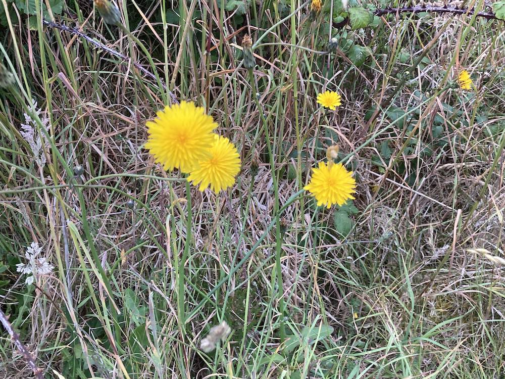
Starting at the large lighthouse, I walked around the headland, much to the consternation of the terns and oystercatchers who were nesting there. They kept track of me until I was out of their danger zone. Key areas on the beach are fenced of to prevent the public from inadvertently or advertently intruding onto nest sites. There were several stonechats too keeping watch from their vantage points on the gorse and shrubs inland, alerting their pals to my presence. The beach is mainly pebbles of assorted sizes and the solid land too is a mix of pebbles and sand dunes with a bit of soil and grass on the top in places. It is very unstable and is constantly being unearthed by the winds, rains and seas. The vegetation grows low around the periphery of the beach but when you move even a few metres inland, it has a chance to grow taller and dominate more. The flowers that grow abundantly around the seashore all around the island are miniscule here, holding on for dear life, but hold on they do, and in the 40 minutes I was out and about, I took 30 photographs of different species, a few of which I have put in the slideshow at the end for you.
Photo courtesy of lighthouseaccommodation.co.uk showing the foghorn and Winkie
The main lighthouse in the top photo was completed in 1818 , with 124 steps and a 105ft tower. Winkie, in the middle was completed in 1890 and designed to avoid high water tides being 33ft above sea level. I suspect the difference in height has grown now with the shingle build up in this area. I didn’t walk on the pebbles but tried to walk on the grassy tops, which have eroded away in many places. Indeed, even though not a deep drop from the ‘cliff’ to the beach, it would not pay to walk too close to the edge as there are many overhanging edges. Unfortunately, this scatty terrain meant I had to curtail my walk as the path that had been gradually climbing came to an abrupt and unexpected end at a ‘precipice’ with no means of continuing unless I retraced my steps and walked along the beach towards Ramsey which would have been a good few miles circular walk. I didn’t take a photo of this, but you get the idea from this one, taken a little earlier, slightly further north:
The coastal footpath is signposted to walk along the beach and when the tide is further out this would be possible; but not today, so I turned slightly inwards and back to the car. The area adjacent to this section of coastline is being reclaimed so there really are only two choices – walk along the beach or walk along the road around this area. A word of warning. It is important to check the tide times if you intend to do the beach from Cranstal to The Dog Mills, otherwise you may find yourself running out of beach at high tide!
I had planned to walk along Marine Drive in Douglas on Wednesday but it may be a step (or many steps) too far for my ankles/feet, but we’ll see. I hope to be fit enough to lead my U3A walk on July 14th as this had to be postponed this month.
The slideshow starts with the 3 buildings in line with one another, the old lighthouse, the foghorn peeping out and the newest, Winkie, on the right, then the rest of the slideshow is of the wonderful spring flowers.
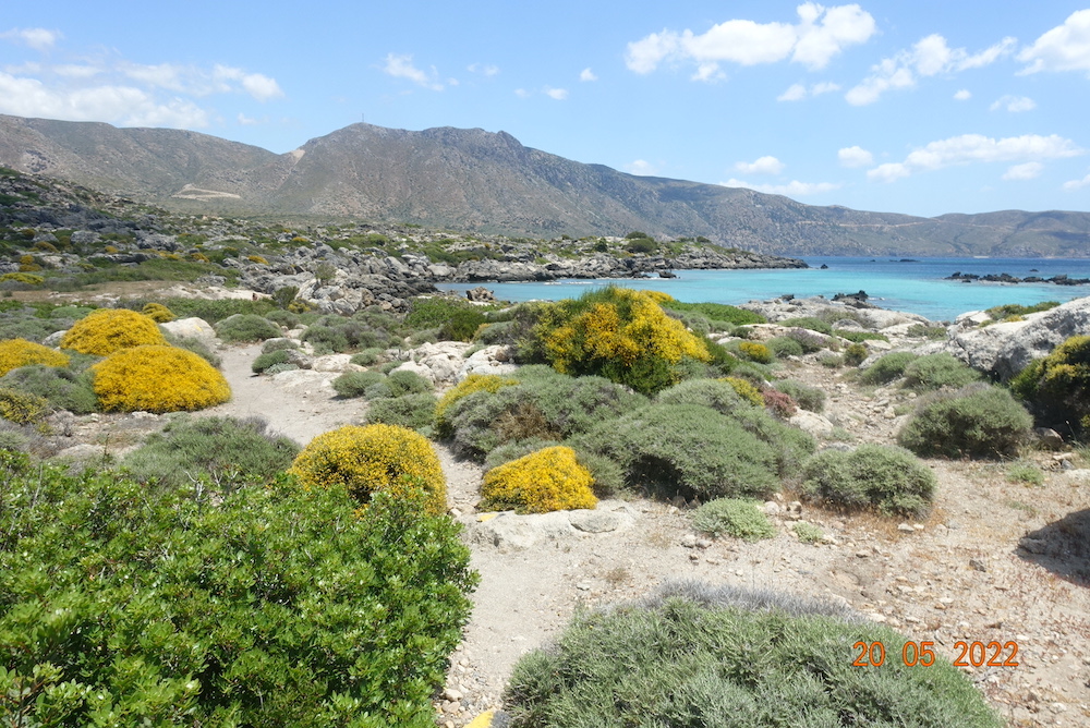
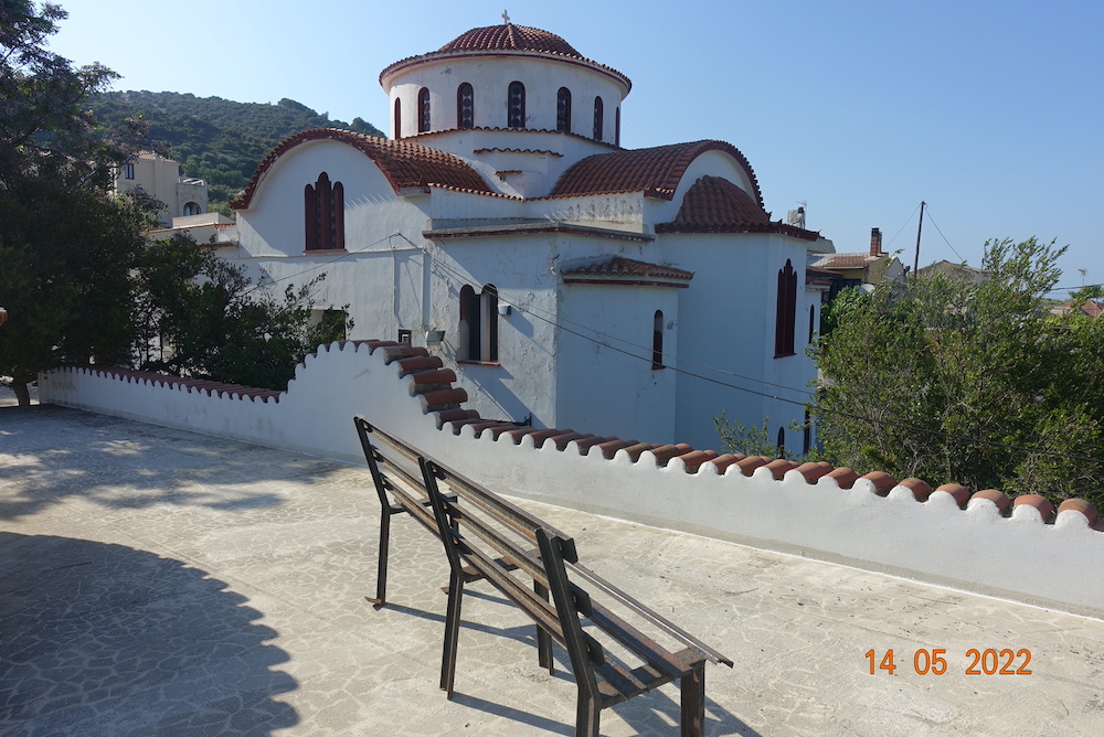
Yes, I know it’s not the Isle of Man, but reluctantly I cannot do any walks at the moment as I have an ankle injury sustained while I was… in Crete, two weeks ago.
This was a walking holiday but I was not sure how much walking I could actually do, so on the spur of the moment I put a sketch pad in my suitcase along with my walking boots and off I trotted to Crete. I have been before, but not stayed on the western side. I had hoped to do the Samaria Gorge this time, at least that was my intention.
We stayed in a beautiful 4 star hotel miles from anywhere in a village called Spilia, a little distance from Chania. If I wanted to do any walks by myself this would necessitate a 32 mins walk each way to the nearest village to use public transport. But I am not complaining. The hotel was so relaxing, with two lovely swimming pools; the food was excellent and each room was completely individual and all scattered around the complex. It had originally been an olive pressing factory.
I did some walks with the group, alternating days, sometimes doing my own thing and yes, I did do some sketching, sometimes just 30 mins sketches and at other times adding in watercolour, but nothing taking more than 2hrs from start to finish. This was an absolute joy and has opened my eyes to painting ‘plein air’. I never want to have to paint anything from a photo again. Just give me an image and let me and my imagination paint the picture.
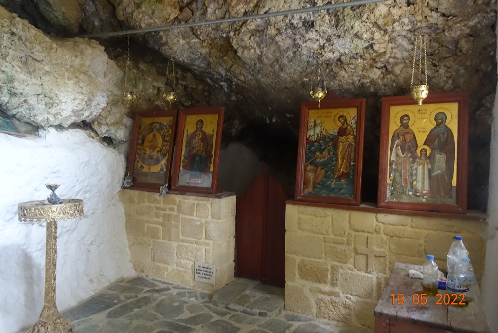
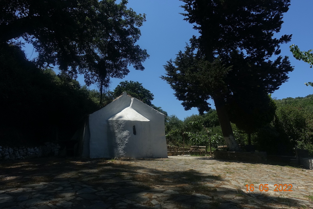
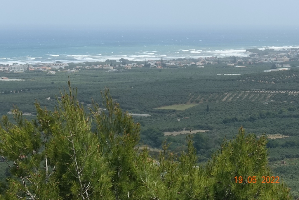
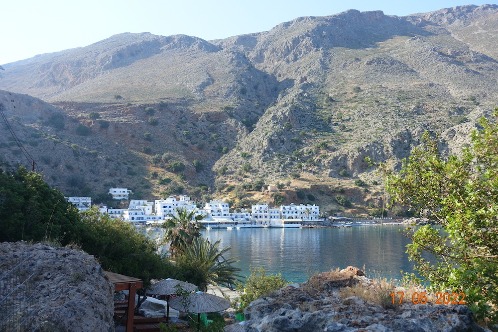
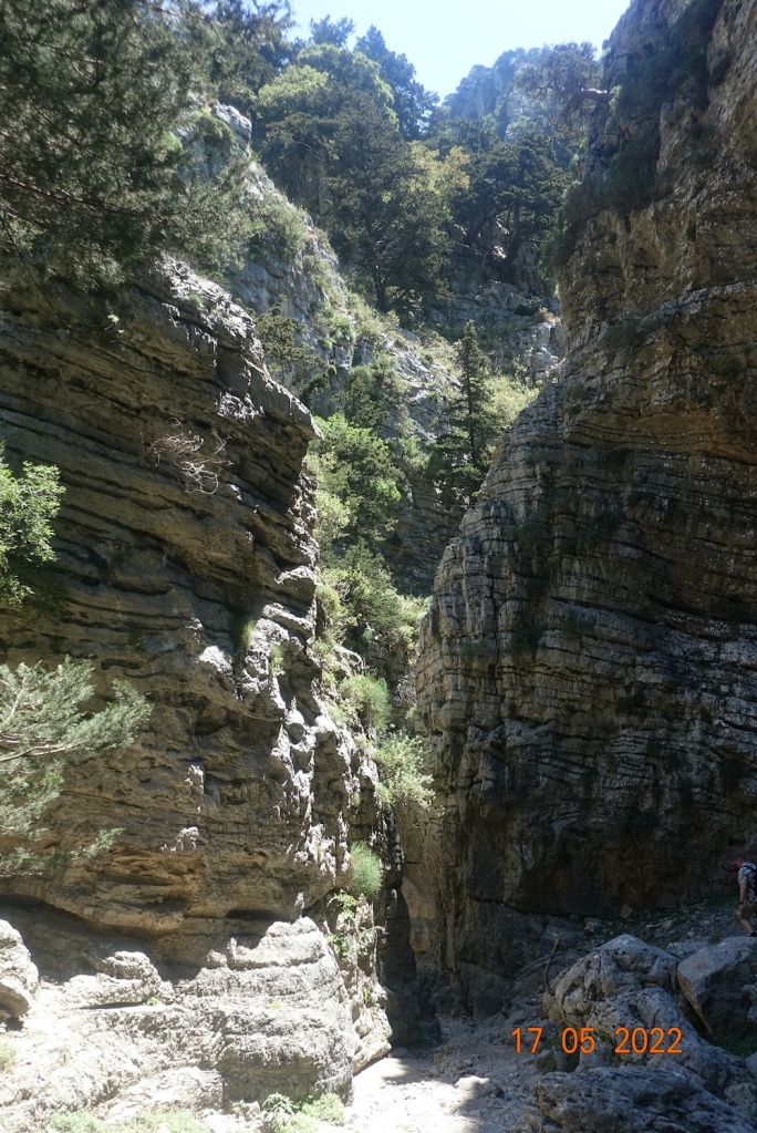
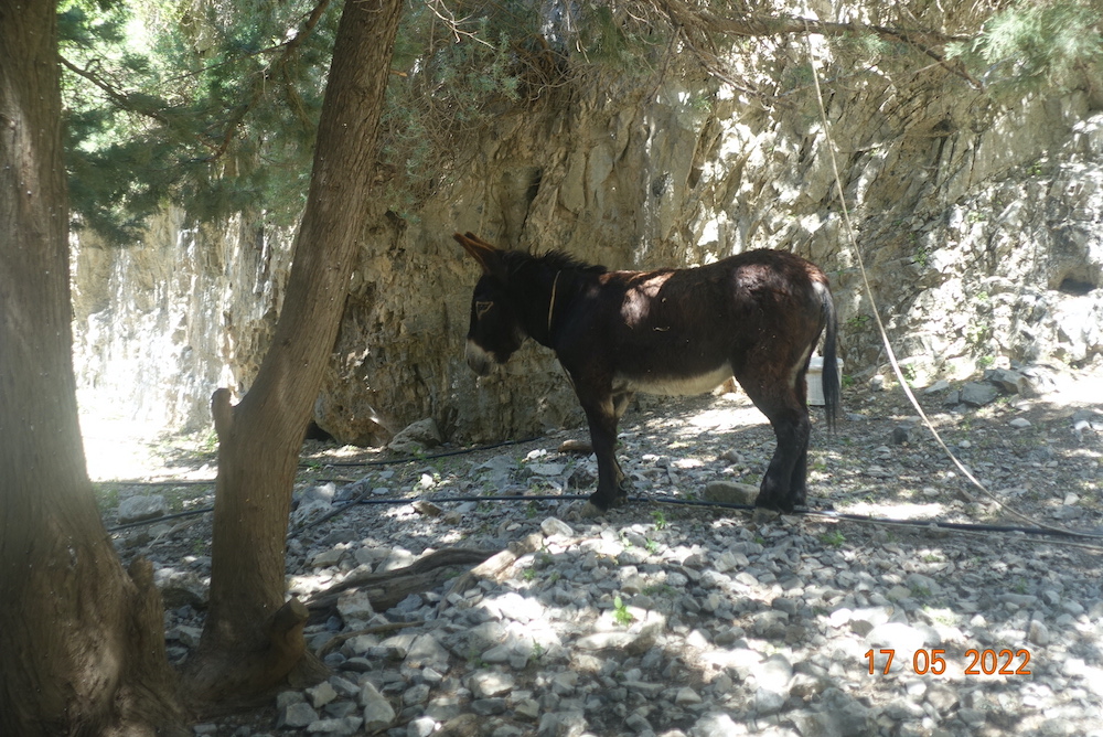
My highlights of the week are probably rather different from the rest of the walking group. The intrepid walkers did do the Samaria Gorge, but I and others opted for the Imbros Gorge, this being the shorter option and with the opportunity of a boat ride to otherwise inaccessible villages along the coast. I completed the Imbros Gorge in under two hours, then did a quick sketch of a village by the sea and then Loutro after the boat ride. The weather of course, was just wonderful, hot and sunny, but not too hot. Other than that, my favourite times were spent on my own, walking up the hill to the magnificent St John’s Cave at Spilia, seeking out other lesser known tiny chapels built into the rocks, and paying for a tour to Elafonisi beach on a day when nobody in their right mind would think of spending time on the beach as it was really windy, open and exposed! It looks idyllic on the photos but they are deceptive. It was extremely windy! But I loved it, and despite sand blowing all over my paints and painting, my water getting blown over time and time again, and the wind and sun drying out the paint as soon as it landed on the paper, I have a sketch painting that I positively like. It has life and vibrancy, not surprisingly rather more than was actually present on the day. The odd thing about Elafonisi is that the coastal footpath is certainly not flat and even. You have to walk through a boulder field, often clambering over rocks taller than me, but offering views of the most beautiful coastal nature reserve. The E4 footpath goes right round the island. Now that sounds like my kind of walking, at least in my mind. I would go back there again should I revisit Crete, but take a little more care as it was on the last stretch of this that I twisted my ankle and it still swells and bruises two weeks later if I walk on it.
The cave of St John’s at Spilia was a real bonus. I didn’t expect it to be so spectacular. It was huge, with lots of nooks and crannies, so I was able to sit there with the dog I acquired on the way up and just do an outline of the pillar cave. On returning to the hotel, I spent a couple of hours painting it from memory. It is so nice to have 5 sketches /paintings all in one sketchpad and I shall take this with me every time I go away to add others to my collection. Florence will be my next trip in the autumn – just two or three days, but time for my more experiences and sketching. I think a sketchbook will be more memorable than any photo I could take and when I am in my dotage I shall enjoy reminiscing about my time in Crete and other places I have visited.
The HF walking party were great fun. We all got on together so well, and there was a lot of laughter, eating and drinking, and until I did my ankle, we played table tennis too. Thank you to everyone who made my holiday so enjoyable. I shall try and put behind me the absolutely dreadful treatment we got from Easyjet when our flight to the IOM was cancelled having been half way round England before taking us back to Gatwick and totally abandoning all the passengers in the evening and not even providing any food or accommodation! To make matters worse, there were no flights for 3 days. As you would expect, I found an alternative and was back on our island the next day.
So I finish with a slideshow of photos to whet your appetite. Oh, and if you wish to try out the hotel it is called Spilia Village and you can find out more here: https://spiliavillage.gr/
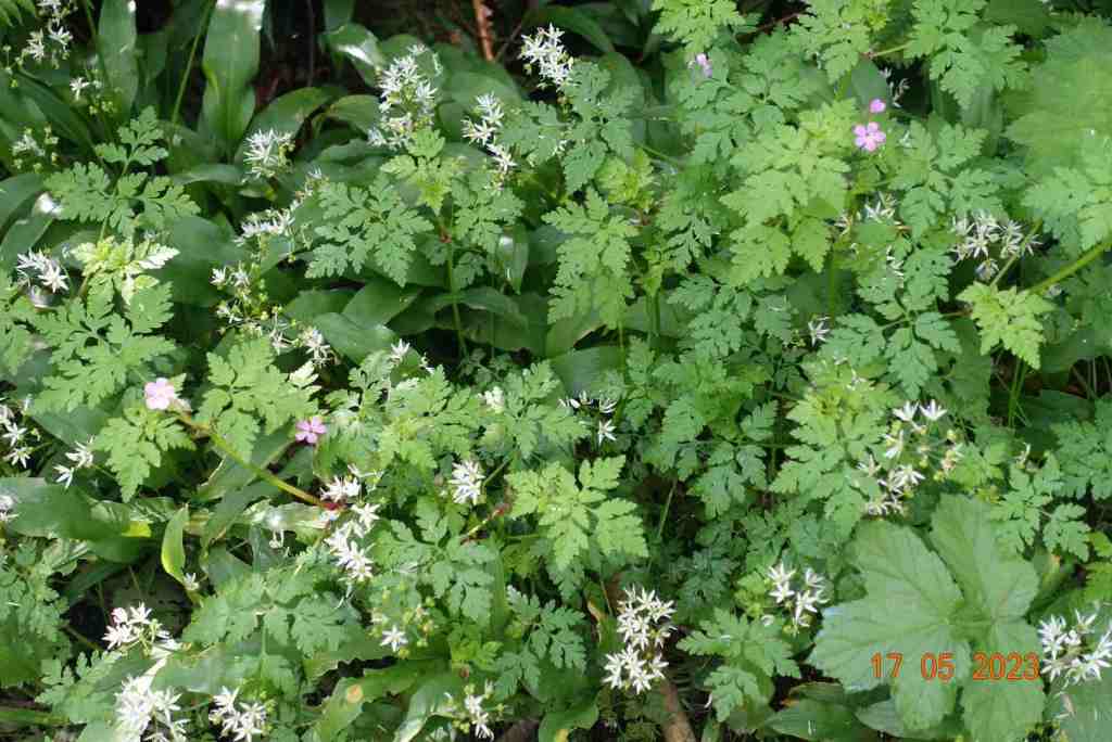
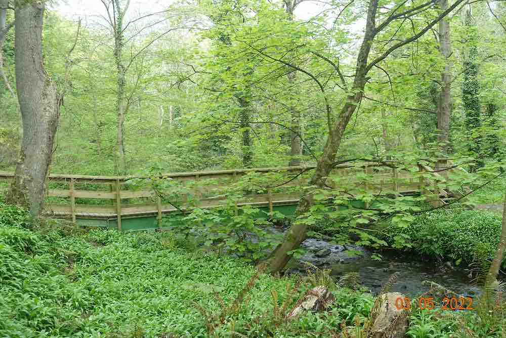
This walk has a lot of stiles as commented on by many of my group but by compensation such a lot of beauty – a tranquil river, spectacular spring flowers, historical features and distant vistas. Having walked this route twice recently as I was leading a U3A group along these paths yesterday, I am amazed how a single week can make such a difference. The wild garlic are now out in full force, whereas last week they were just appearing. The field grass is about a foot tall in places now and the meadows of lady’s smock (cuckoo flower) were even more beautiful and the orange tip butterflies were enjoying their abundance.
I think my wildflower and historical notes really inspired my walkers as it took us an hour and a quarter just to walk a mile up the glen to Athol Bridge as we would stop at anything interesting or unusual. Perhaps I should have publicised it as a nature walk.
We began by grouping together on the bridge by the ford while I gave them a short history of the river and Ballasalla, with the aim of showing that river, albeit fairly small, has played a significant role in this landscape. There have been numerous mills over the centuries mostly involved with the cotton industry (rather than a flour mill). As yet, we don’t know quite where the cotton came from, whether or not it was grown on the IOM. Most interesting, for me at any rate, was the wide number of occupations that were found in Ballasalla in 1837 – two blacksmiths, 3 boot and shoe makers, one brewer, 3 joiners and carpenters, 2 millers, 2 milliners and dressmakers, 8 shopkeepers (!), 3 tailors, 1 tanner, 4 taverns etc etc. You can read more here if you are interested. https://www.gov.im/media/633197/silverdaleappraisalwithpicsv2.pdf I guess today there would still be variety but not closely linked to the natural environment in the same way.
We walked along the riverbank to look at the violets, alexanders, celandine, herb robert, red campion and wonderful wood anemones that were just beginning to go over but still looked fab. There were bluebells and a few wild garlic here and there in this section, but much more wild garlic further on. Deeper into the glen we saw wood sorrel, stitchwort and masses of wild garlic that would challenge Wordsworth’s view of golden daffodils. In the photos I have included my painting of the mineral water factory, which is really part of the old Cregg Mill buildings. Just before the mill where there is the boating lake is the old water wash ladder, presumably for cleaning the cotton, seen in the middle photo below.
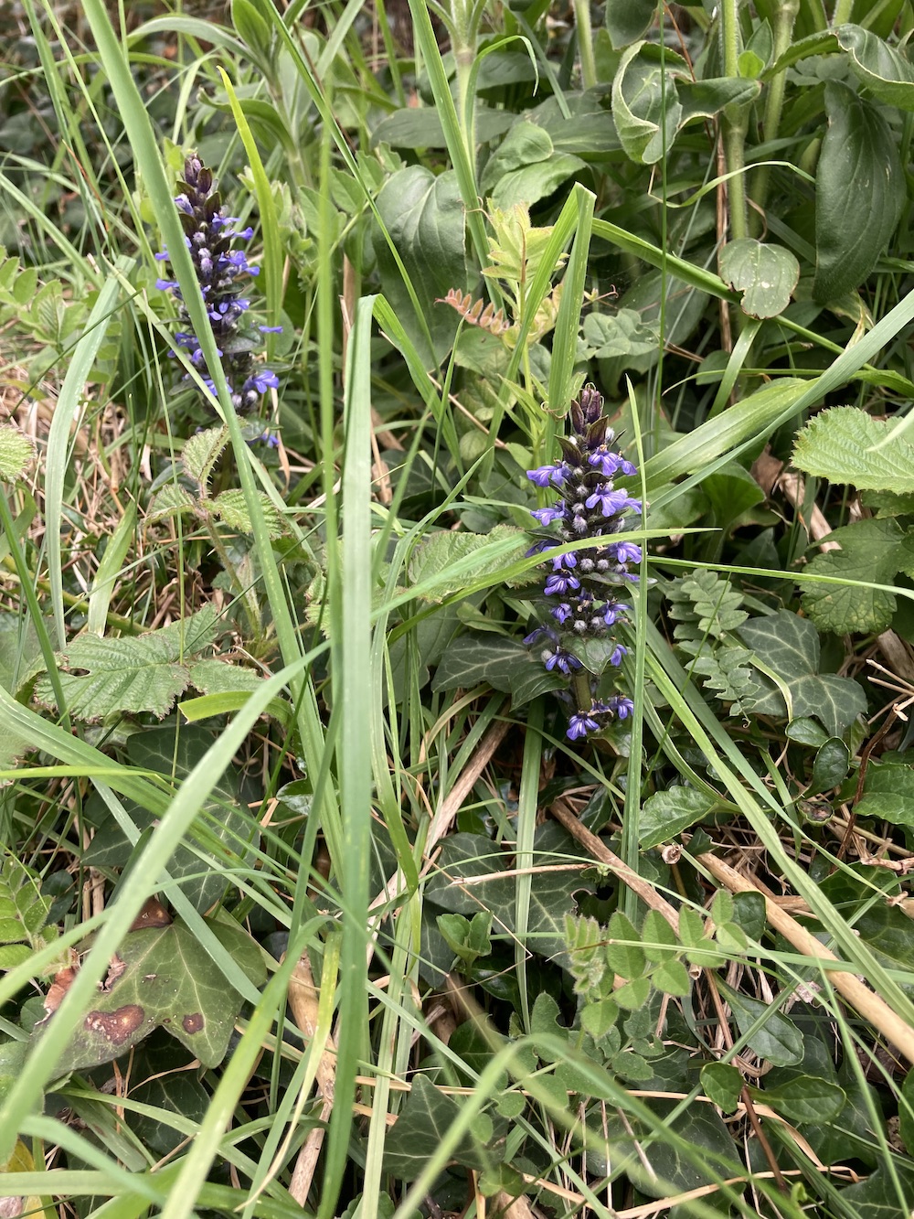
One of the unfortunate aspects of this walk is that the river footpath on the other side of the Ballamodha is closed necessitating a short walk up the hill. Suprisingly there were more wildflowers on the embankment, inlcuding ivy-leaved toadflax and bugle, the latter not usually considered to be a wild flower, and some distance from any habitation. We even saw some trailing St. John’s wort – that wasn’t out last week, neither was the garlic mustard that we saw at Grenaby bridge.
As we crossed the road, we took a farmer’s grassy track. The pussy willow looked beautiful, and the lamb’s looked delightful gambolling in the fields. We stopped for a very belated lunch (2 miles and 1 and 3/4 hr of walking!!) at the creepy doll’s house on the corner at Grenaby. It is in a desperate state of repair but it is a fantastic location and is up for sale at £500,000.
Normally, I don’t like road walking, but we had a walk of about 15 minutes along a very quiet lane. What was particularly nice about this was that we could walk and chat alongside each other and it was very pleasant. We then took field paths, saying hello to some beautiful bay and black horses who seemed pleased to have some company, passing over many rickety stiles across fields with massive clumps of lady’s smock, a mound to negotiate and surprisingly beautiful gently sloping hills to the north of the quarry, and finished by taking the back path by Ballahott into Ballasalla with a ‘surprise’ ending. Having started by walking through masses of wild garlic, we were able to walk a less frequented path that took us round the back of the stunning art and craft houses above Rushen Abbey, that led into woodland brimming with wild garlic in flower right by the car park, just after a most beautiful field of dandelions.
The walk was actually 5.5 miles and would usually take about 2.5 hours but on a day like this, with so much to see, allow yourself lots of time. We took 4 hours and it wasn’t a minute too long.
To finish, here are two maps of this area. The first shows just how narrow the glen really is and what a micro climate it creates for itself and the second is an old map showing how tiny Ballasalla was in days gone past.
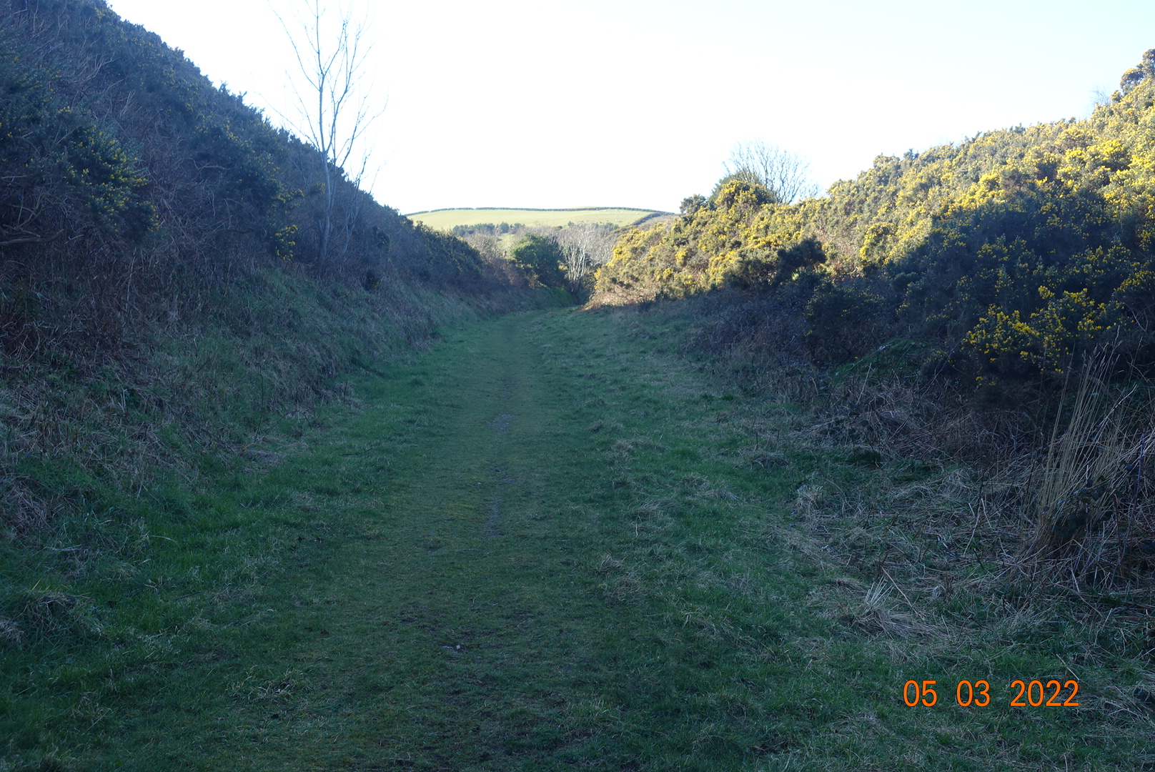
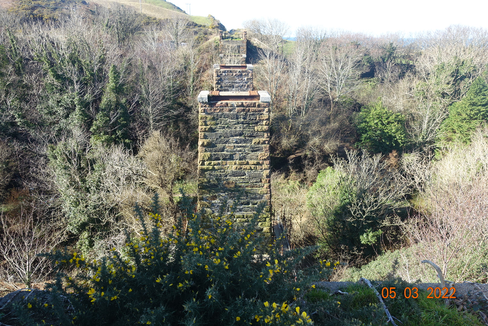
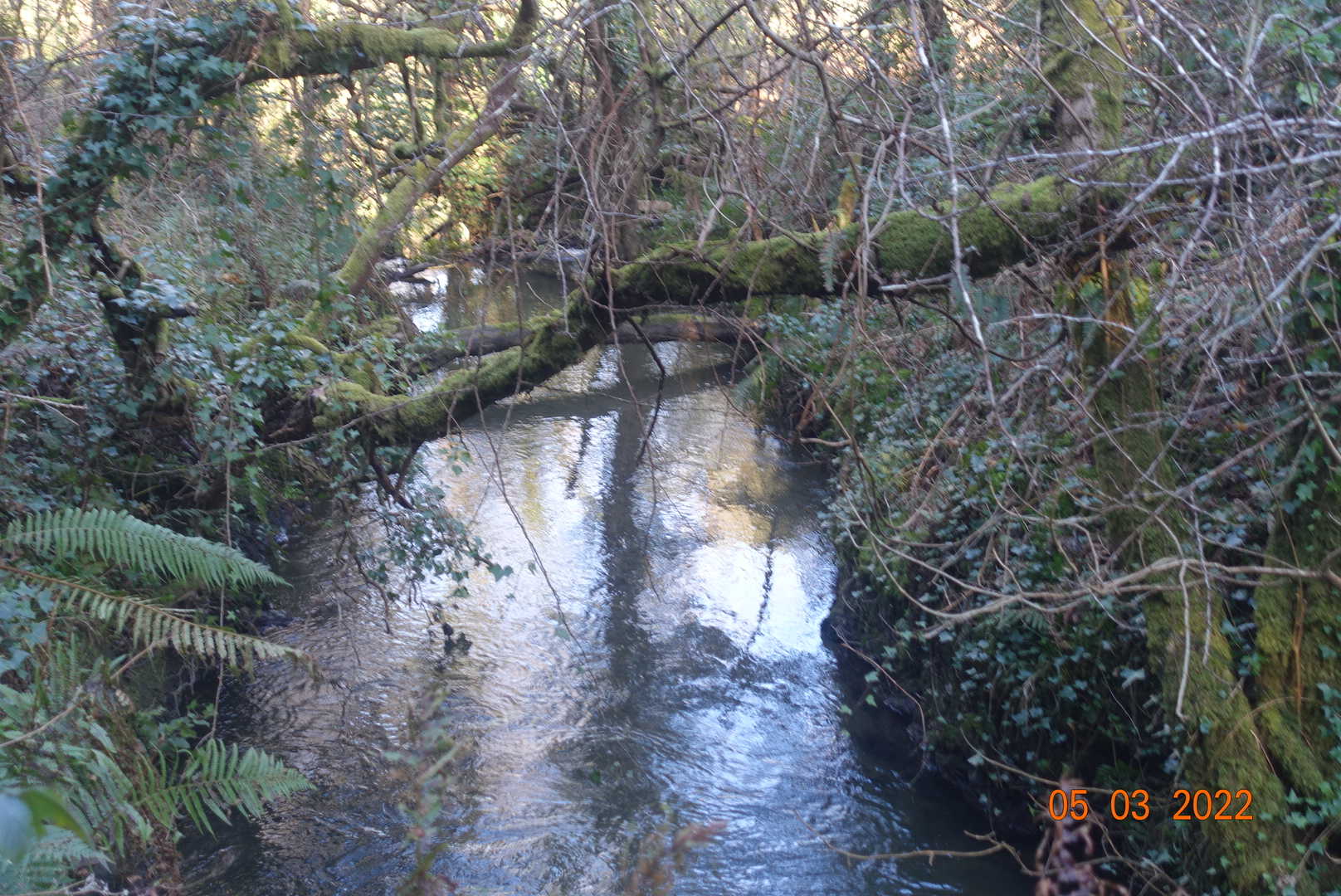
This short walk is spectacular, especially if you do it after rains as I did today. The walk starts at the Glen Wyllin campsite, or if you prefer you can park in Kirk Michael village. There is a path right behind the cafe with steps that take you to the old railway line. This path has not been dug up and widened as has happened to the railways tracks in other parts of the island and it still retains its natural charm. Incidentally, if you do park in KM you will have to descend into the valley and ascend the other side as the stone platform of the viaduct has been removed and only the pillars remain. The path is mainly enclosed but every now and again you catch a glimpse of the sea to the west and the hills to the east.
We follow the railway line until it meets a small lane after about a mile just before Glen Mooar. Prior to this, you will go under a couple of bridges. At the lane, the footpath sign tells you to cross over the road and continue through a gate. The path continues for only a short distance, as guess what, the viaduct has been removed at Glen Mooar and again just the supports remain standing, bringing you to a firm standstill. A path downhill has been created. This is a fairly steep descent, but only for about 60ft or so. As you descend you enter another world, away from the farmland and distant vistas of hills and sea. Now we have a tree-lined river with steep banks on either side. The lower path is closed so unfortunately this necessitates more undulating ascents with minor descents and more steps. The gains are great though, as the woods are so very pretty and there are some very large beech trees guarding over the valley. It will look lovely when the spring flowers come out. The cover photo shows the view through the trees to the hills.
At one point you will reach a high grassy area where there are the clearly visible remains of a 10th century keeill (Patrick’s Chapel), priest’s cell and graveyard. It is a very peaceful area for contemplation, meditation or prayer while you listen to the birds singing in the trees.
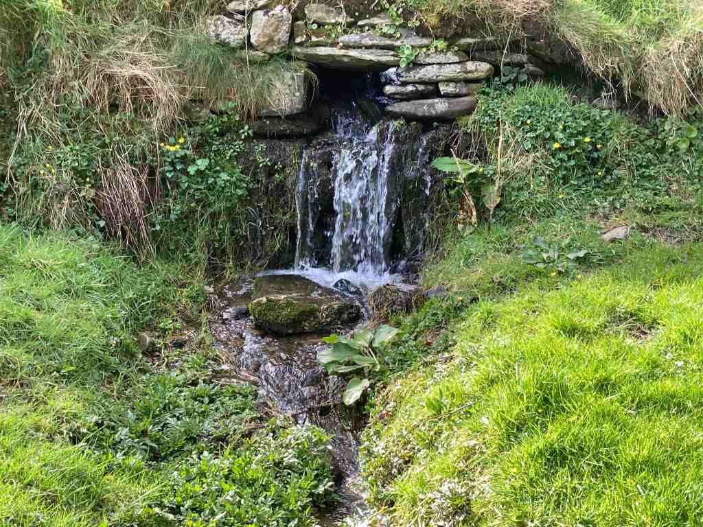
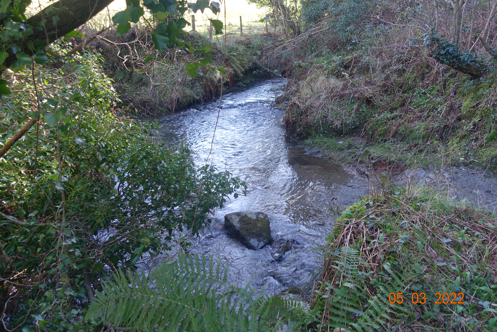
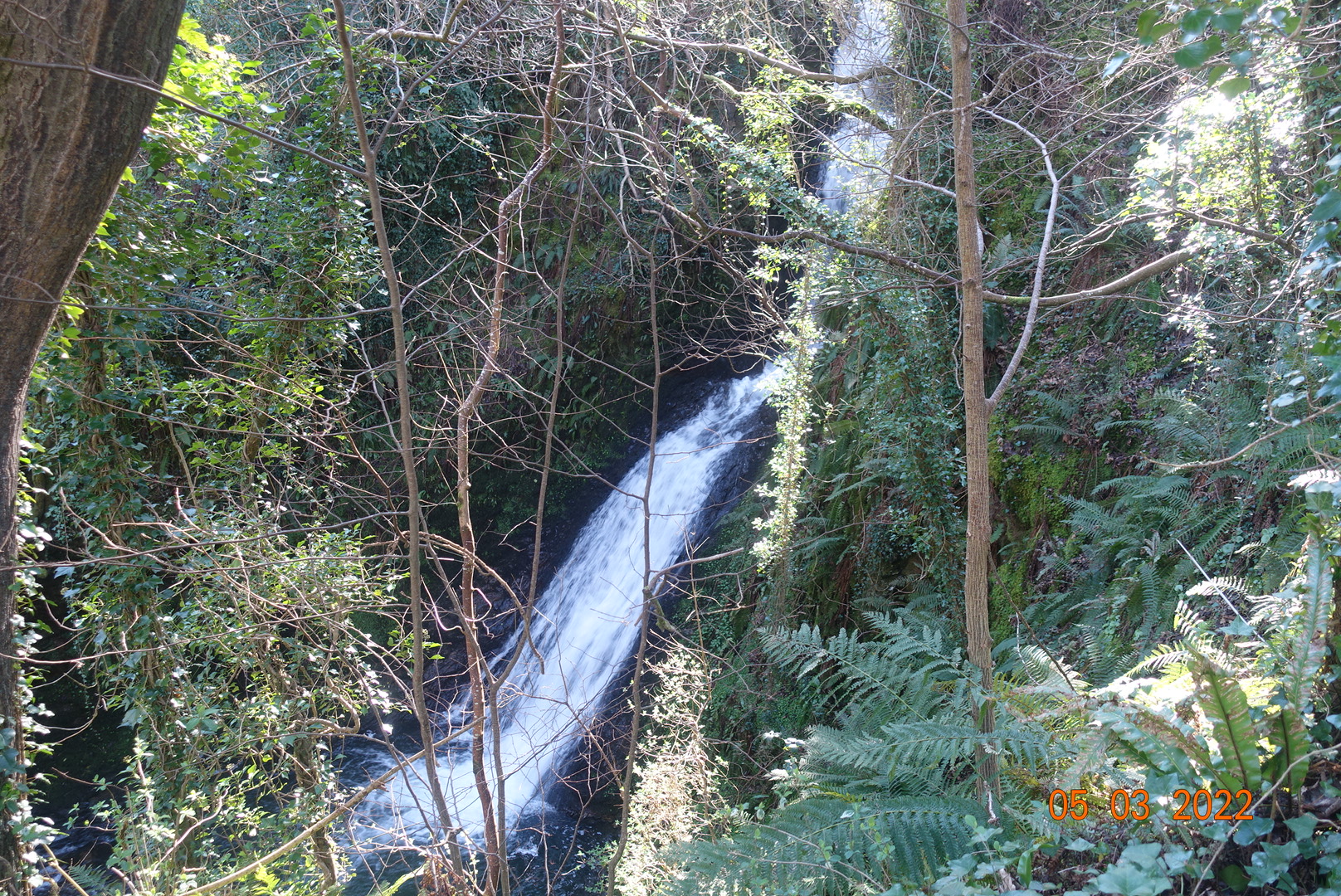
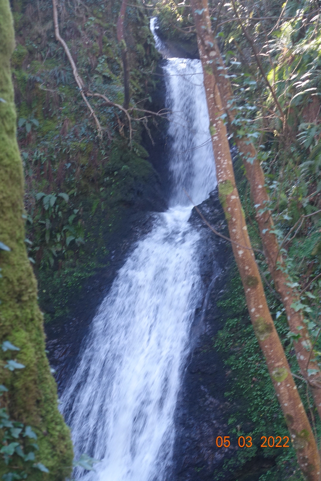
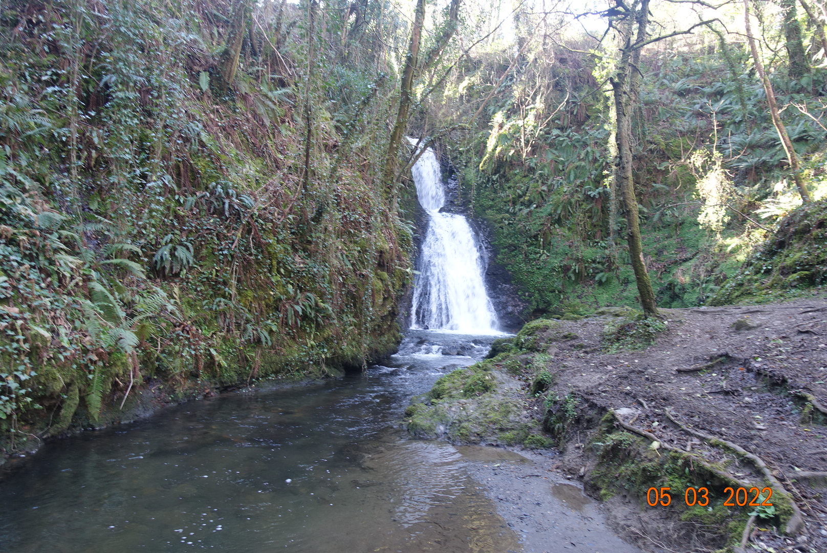
A little further on and the sound of running water becomes louder and louder, although it isn’t easy to see anything. The path takes you to the top of the waterfall called Spooyt Vane (White Spout), where all you can see is where a small stream begins to gurgle down the rocks. Take the permissive footpath left, down more steps (sorry), and you find yourself in a dell with the wonderful waterfall at its head, with water gushing down into the pool below in a sequence of stages. To the right the area is hollowed out, which probably suggests the waterfall has changed direction over the millennia. I have rarely seen the waterfall so full and it was captivating.
Crossing the bridge, we follow the track along the top of the valley to join the road. There is a small parking place for those making single journeys and Glen Mooar is worth a visit on its own. At the road junction you will see an old chapel which was constructed in the 1860s as a Sunday School and Mission Room for children who couldn’t make the heady journey to Kirk Michael for schooling.
The route continues along the lane uphill past a few houses and farms. As you ascend notice the soft green hills on the left. The other side of these hills is where the recent archaeological dig has been going on for the last few years, unearthing remnants of people and posessions from the Bronze Age (over 3000 years ago). You can find out more about this here: https://www.bbc.co.uk/news/world-europe-isle-of-man-48806185
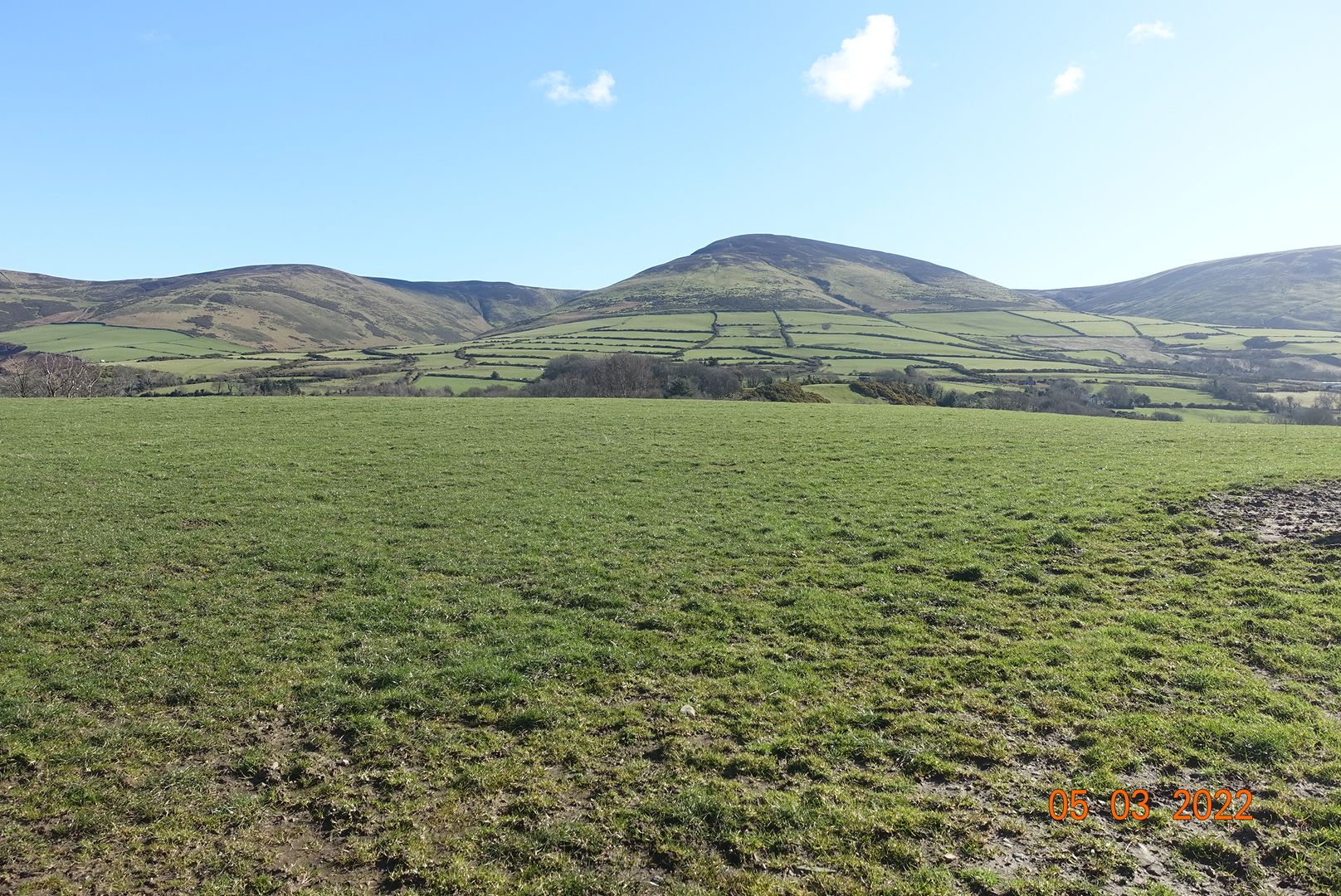
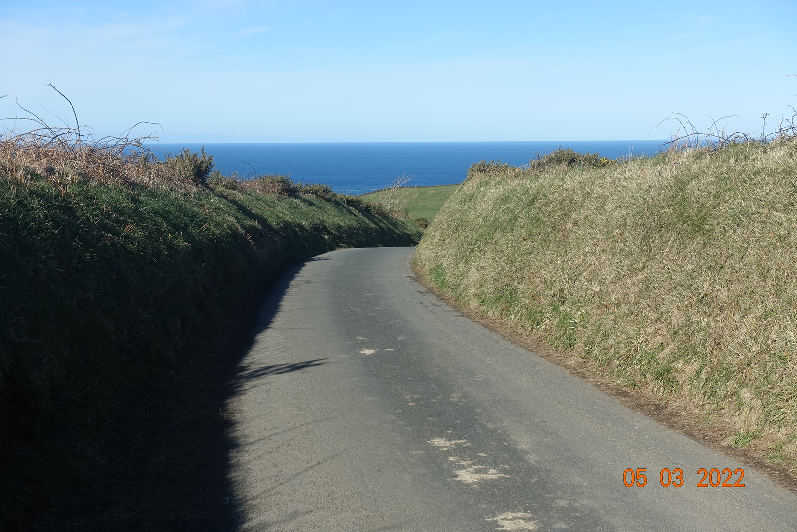
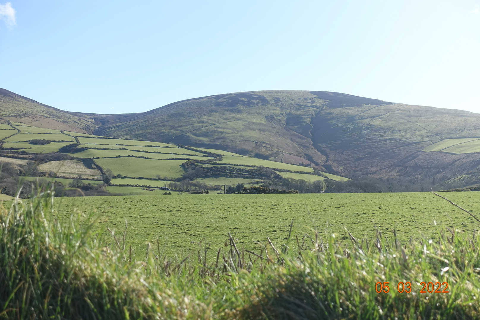
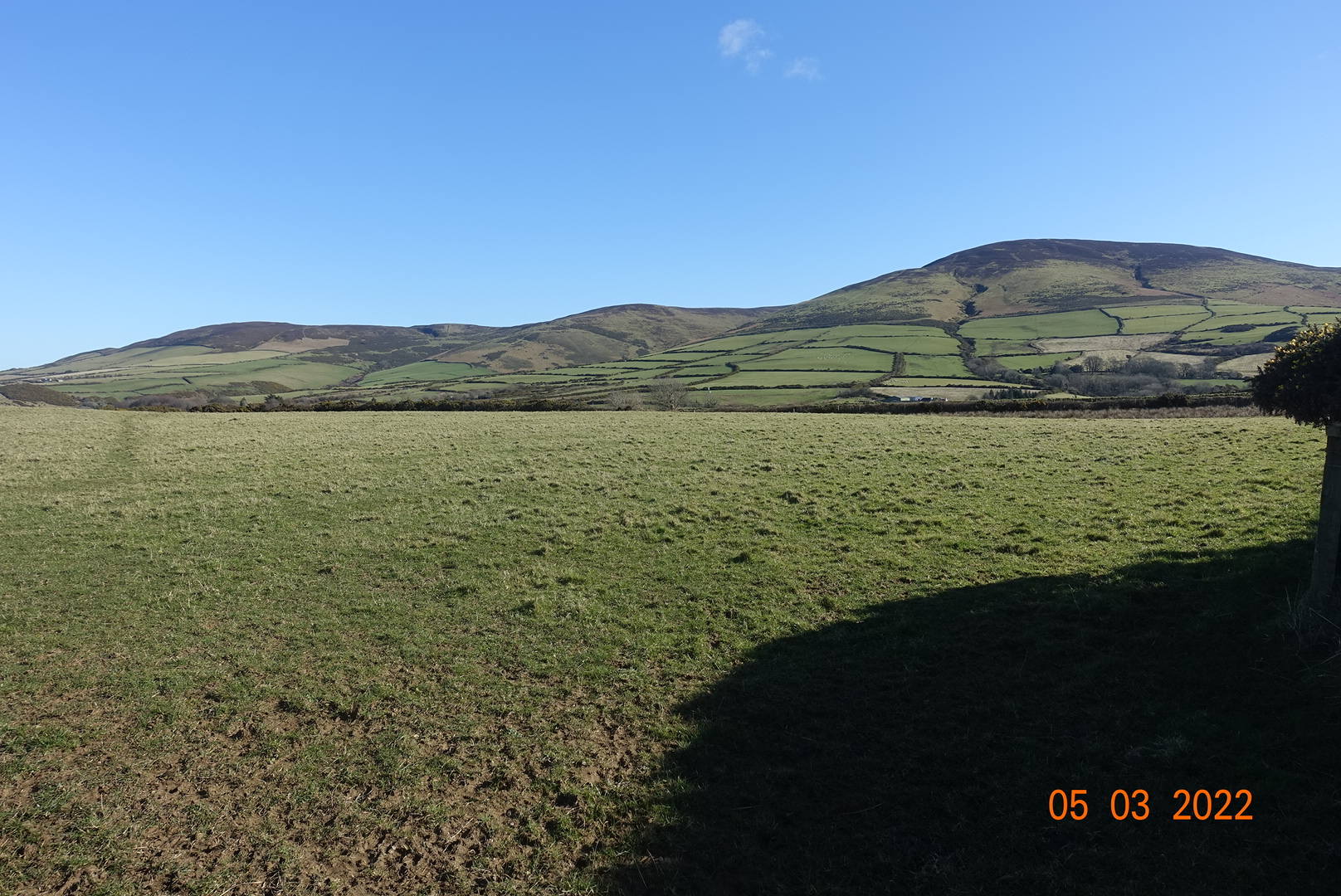
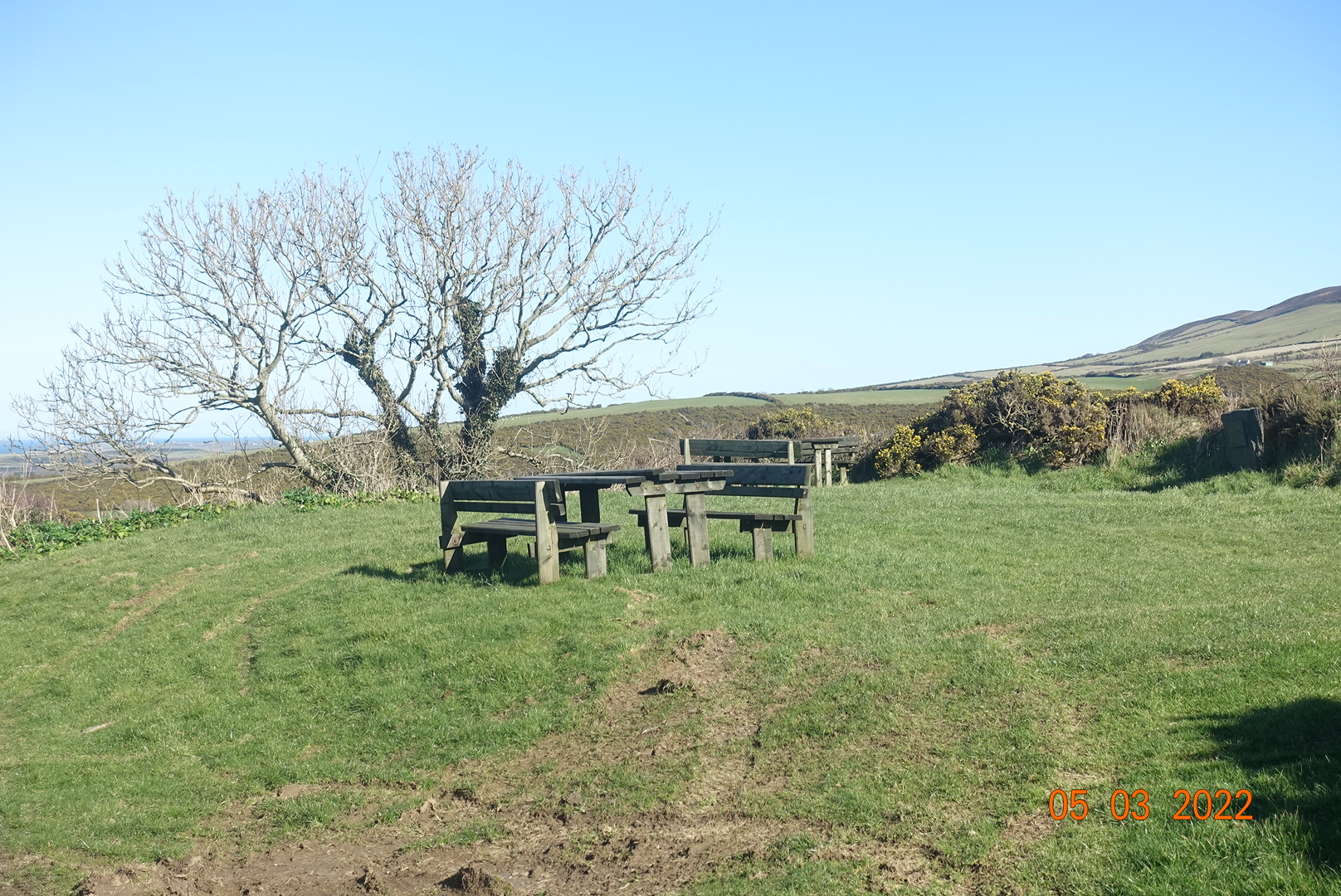
At the top of the lane, there are panoramic views of the hills: Sartfell (454m) to the right, Slieau Freoaghane (488m) in the middle, Slieau Dhoo (420m) just behind this and Slieua Curn (351m) on the far left. They look so inviting on a sunny day like this and they make a fine ridge walk. These will be the subject of another walk at some point. Someone has thoughtfully placed some picnic benches along this section of the road so you can stop and enjoy the views as long as you like. You can even see Scotland from here if you look very closely – it was very clear in reality!
For now, we continue with our descent back to Kirk Michael following a track that becomes a footpath and leads to Cooildarry Nature Reserve (owned by Manx Wildlife Trust). It is possible to include an optional extra mile or two walking along the railway line north and then dropping down to the sea, for those who want a slightly longer walk.
There is such variety and interest in this walk, and as long as you don’t mind steps, you will find it a very rewarding experience. Altogether it is about 4 miles including the visit to the Nature Reserve and 545ft of ascent and descent., with an optional extra of 1-2 miles depending on the tides.