I have really enjoyed my few days in Tideswell. The countryside is a perfect example of the UK’s traditional green and pleasant land and it has a timeless feel to it, despite evidence all around of progress and technology, in the forms of masts and wires, a variety of road signs, and cars parked in every nook and cranny on the streets, at least in the old part of the village where the houses were originally built for living rather than housing transport. Some of the properties are very old and opposite the church is a house whose front door is dated something like 1542. What stories that house would be able to tell.
Today, I did a short morning walk of about 3 miles, starting with a trip to the pharmacy to get some nail varnish for my Aunty in Retford, who I am visiting tomorrow. (When I was in Castleton yesterday I asked if there was a pharmacy and was told I would either have to go to Chapel-en-le-frith in one direction or Hathersage in the other, so there are clearly some disadvantages in living in remote beauty spots.)
I took the path that runs behind the cathedral to the higher lane and followed it north. The cathedral itself is worth a visit and has a magnificent stained glass window amongst other interesting artefacts.
Tideswell Cathedral
I had selected a particular road route because I was hoping to avoid mud for once, and the map showed the road descending between two hills, but in reality that was misleading, although the route was still very pretty and it was almost a dale in itself, with a small stream and meadows of wild flowers alongside the road. I turned off the road to take a very straight track that leads to Wheston. This was wide and easy to walk on, and it followed the top of the hill so the views were wonderful. I had to wait while a tractor went past as there wasn’t room for both of us. Wheston is only a very small hamlet but does lead to the entrance to Peter’s Dale, a dale I have not visited on this occasion but shall do another time.
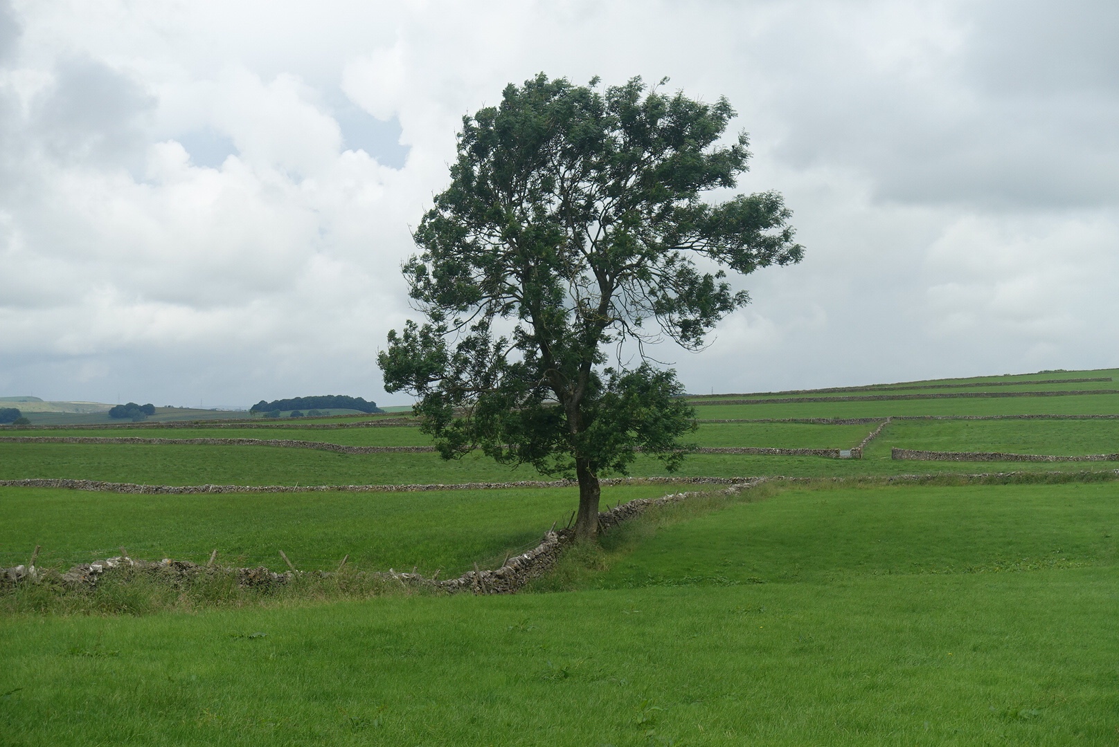
The timeless nature of the countryside
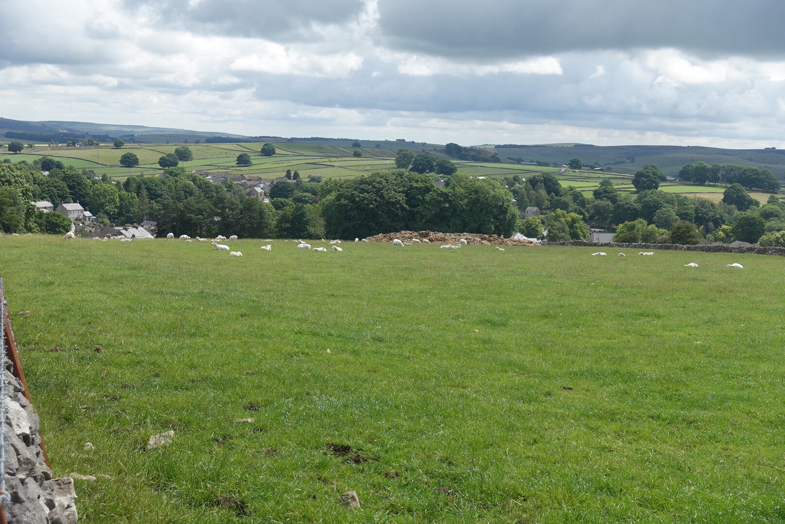
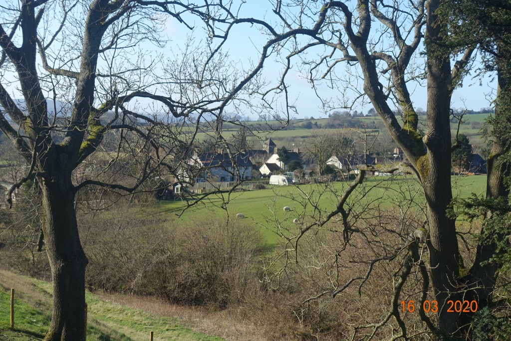
The route back to Tideswell was along another minor lane, and I enjoyed seeing the village from another angle. It is also nice to have an undemanding walk every now and again. So, here terminates my few days on my own, though I did meet up with son James and his daughter Emily yesterday and daughter Sarah this evening, so not entirely on my own. It is so good to see the family after such a long break, and I am looking forward to spending more time with them, and son Matthew, after my brief sojourn to Retford tomorrow.
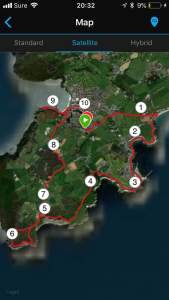
The beautiful old village of Tideswell (north end) and Rockingham Lodge where I have been staying.
I shall definitely return here. There is so much walking to do either from the village or within 15 mins of driving. The paths are well maintained and they criss-cross the countryside to give you miles and miles of roaming, meaning that you can vary your route time after time within a narrow area. And Tideswell itself is lovely and less commercial than some other villages and towns in the Peak District. I can recommend it should you decide to visit Derbyshire, even on a rainy day.
Continuing my brief time away in Derbyshire, I decided to visit the Blue John Caves at Castleton. It is many years since I have ventured down under the ground, possibly thirty odd years ago, as I remember writing a children’s story about it at the time and my young son, Matthew, now with a child of his own, illustrating it. I still have his pictures tucked away in a drawer at home.
I was there early, so there was no queue. I paid my money, requesting an OAP ticket, which prompted the seller to ask me if I could manage the 245 steps down and up! As it was I managed them better than some of the younger people.
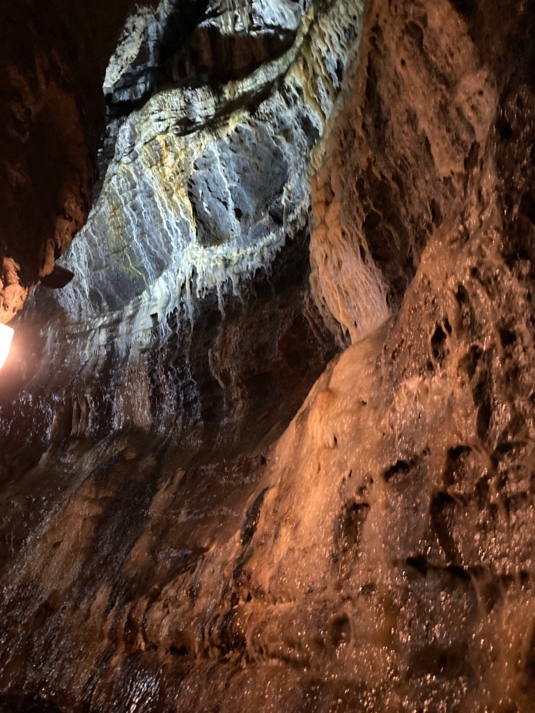
The caves are well lit, and the steps are a manageable height. There is a handrail all the way down, which the guide insists is used all the time, and photographs are only permitted when we stop. Some of the caverns are huge, others only moderately large, and you have to remember that the miners did not have the luxury of neat steps to negotiate and then they had equipment to lug up and down as well.
The mineral called Blue John, is a form of fluorite, a semi-precious mineral, and takes its name from its purple/ blue colour, unique to the two caverns here in Derbyshire (this one and Treak Cavern a mile away), and only found in China otherwise. It is still mined today, in very small quantities, and you can expect to pay quite a lot of money for blue John jewellery. Castleton has many jewellers selling the same.
Then, of course, it was raining, so what else to do but get wet and walk up another dale. This was after I had finished shopping.
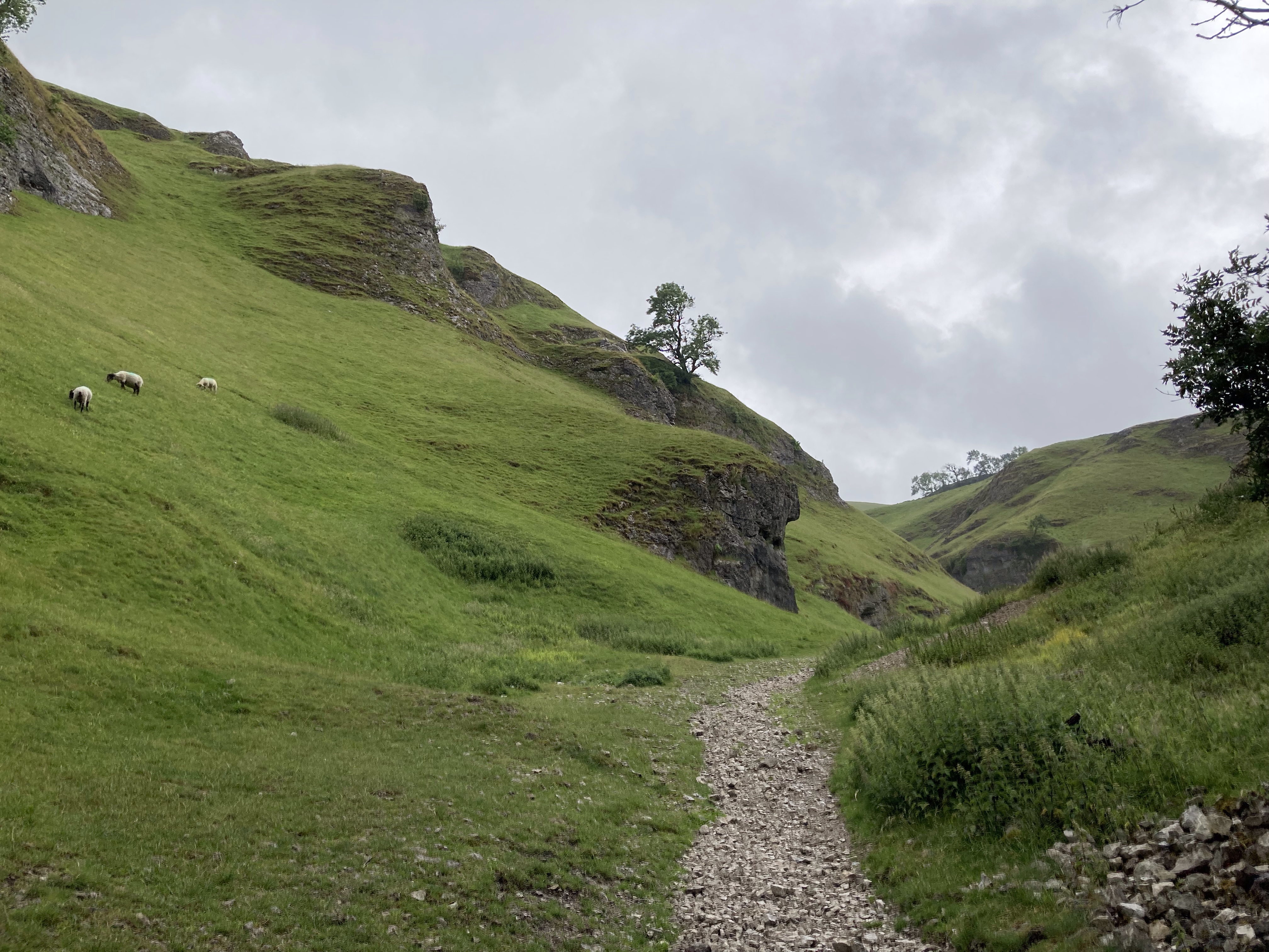
Cave Dale is situated in the heart of Castleton itself and leads back up between the limestone hills. It is about a mile long and it is a glorious dale, and leads you to the top of the range of hills, from which you can get splendid views for a climb of about 500ft, so just a bit more than climbing from sea level to Milner Tower in Port Erin. It is a very gentle, grassy, stony climb, so do be careful on the rocks as limestone is so very slippery when wet.
On the right you can see Peveril Castle towering above you. This is a Norman structure, and woe betide anyone trying to attack. This steep sides were an excellent protection. Below Peveril Castle is Peak Cavern, also known as Devil’s Arse, the only natural cavern in the area, and this is worth a visit. Speedwell Cavern is also excellent, and includes a boat ride.
Cavedale was initially a wet dale, but today the water flows underground. Initially carved out by glaciers, it then collapsed further, creating the narrow gorge at the start. Even two hundred years ago, there was a ‘roof’ to the entrance. So, just think, when you walk through Cavedale, you are walking through history and over the top of an extensive cave system, much of which has still to be explored.
Having reached the top, and only wanting a short walk I followed the top of the hill leading steadily down the grassy pasture to the trees close to Peveril Castle, where the path turns into a fairly steep, stony and slippery path. They views are fantastic, even in the damp, foggy air.
At the most, starting from the car park by the visitor centre this is a 3 mile walk, so an easy walk to do at any time of day, and there are many places to eat and drink when you return to Castleton, and of course, the main other Caverns to visit.
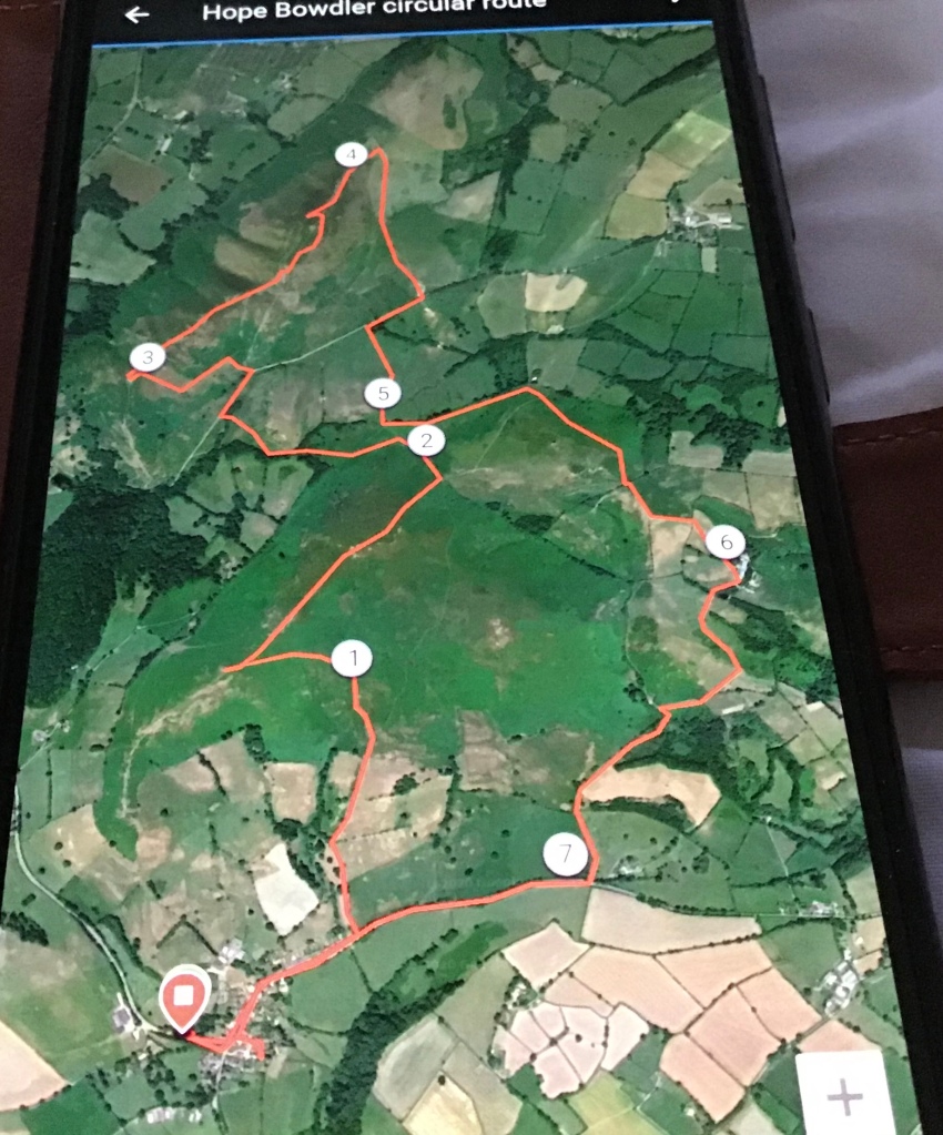
The sky was clear as a bell when I awoke, so an early start onto the hills was in order. I had worked out and memorised a route I wanted to take starting from Hope Bowdler, though whether it would work out in practice was anyone’s guess.
I parked in a lay-by alongside mums taking their children to nursery and walked along the road through the pretty village. I knew my path would be just behind the village on the eastern side of a stream, and I found it without a problem. It was all uphill to the source of the stream, keeping Hope Bowdler Hill to my right.
I fully intended to traverse west across the moorland so that I could take in all the peaks, but you could carry on between the hills if you preferred. There are three mini peaks, all nameless, one around 390 metres, the second about 410 metres and the highest at 426 metres. The views across to the Long Mynd were spectacular and the sun warmed my soul as I walked along the ridge. I should mention there is no footpath marked on the OS map but there is a clear path in practice.
The source of the streamOne of the mini peaks View of the Caer Caradoc range from themini peaks of Hope Bowdler Hill
From here there is a steep and uneven descent that curves around the hillside contouring for a short time, before entering the valley, scrubland and forest that is very very boggy. The paths here are less obvious but there is plenty of choice and as long as you know roughly the direction you want to go, you will get there. As it was, I didn’t deviate from my mental route all day, which rather impressed me.
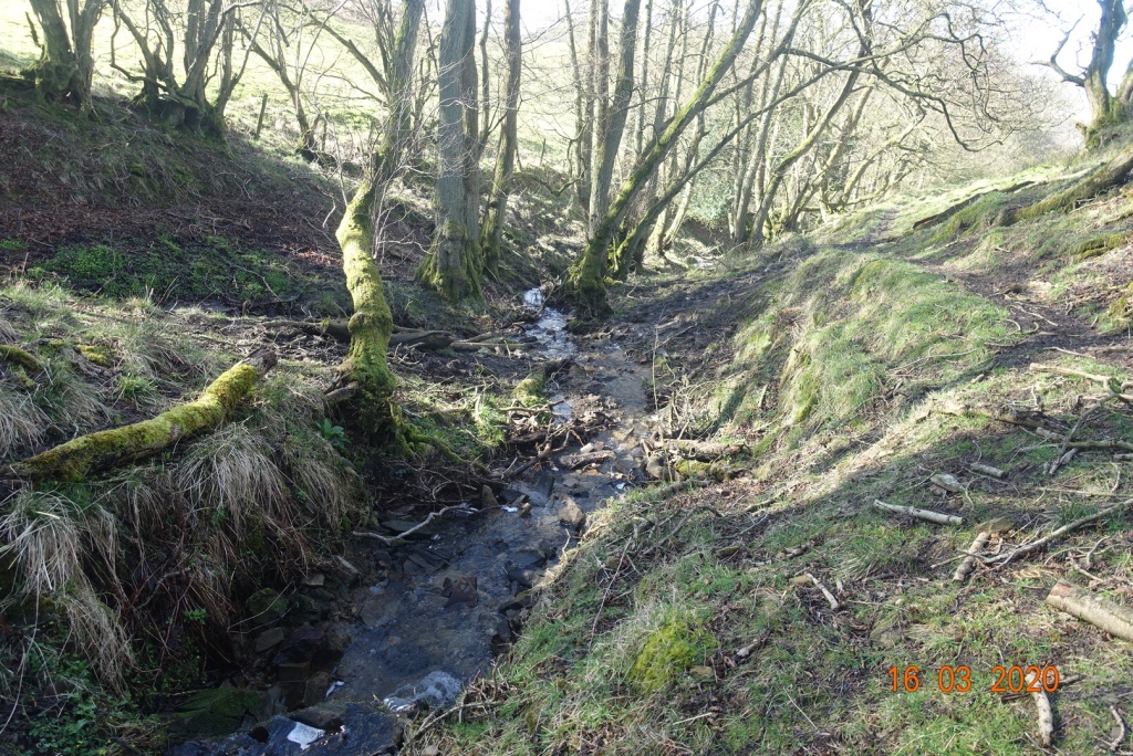
The stream crossing
There are little streams to cross, but these are not difficult and eventually you hit the main ‘thoroughfare’ between the Hope Bowdler Range and the Caer Caderoc range. There is a choice of routes. There is a steep path up to the first crag to the left, but given my physical condition I tend to look for the more gradual routes, so I walked eastwards on the path until I reached a gate and stile.
Going off piste; the stile is at the top
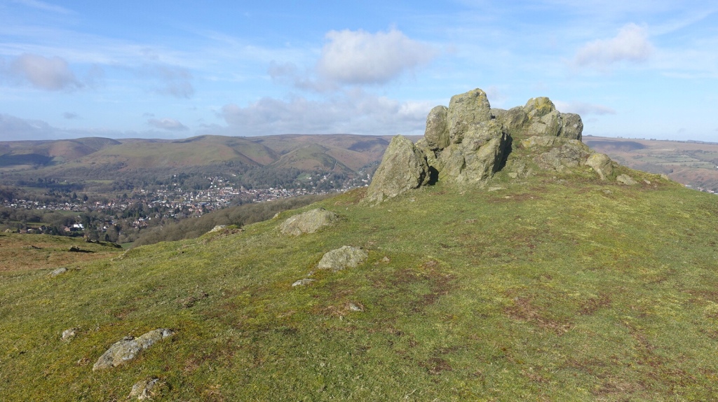
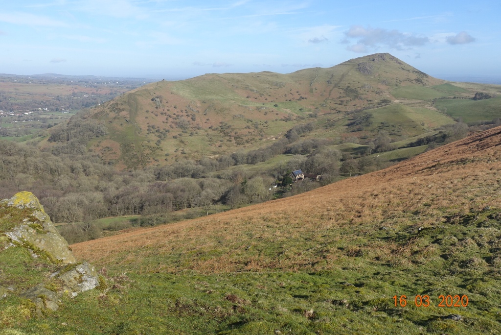
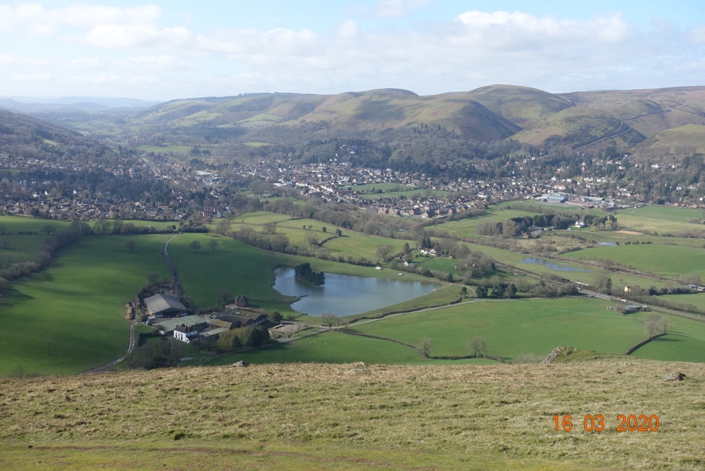
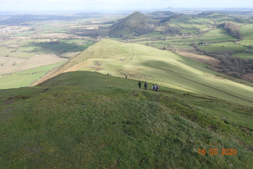
There is a clearly visible route that heads directly to the top of Caer Caradoc, but again I wanted to take in the mini peaks, so I ascended over the tussocky ground to join an easy path to the east to view the nameless peaks. The ridge walk was lovely, undulating and soft underfoot, and there is a slightly steeper rockier ascent to reach the craggy highest point at 459 metres. The views are just stunning from here.
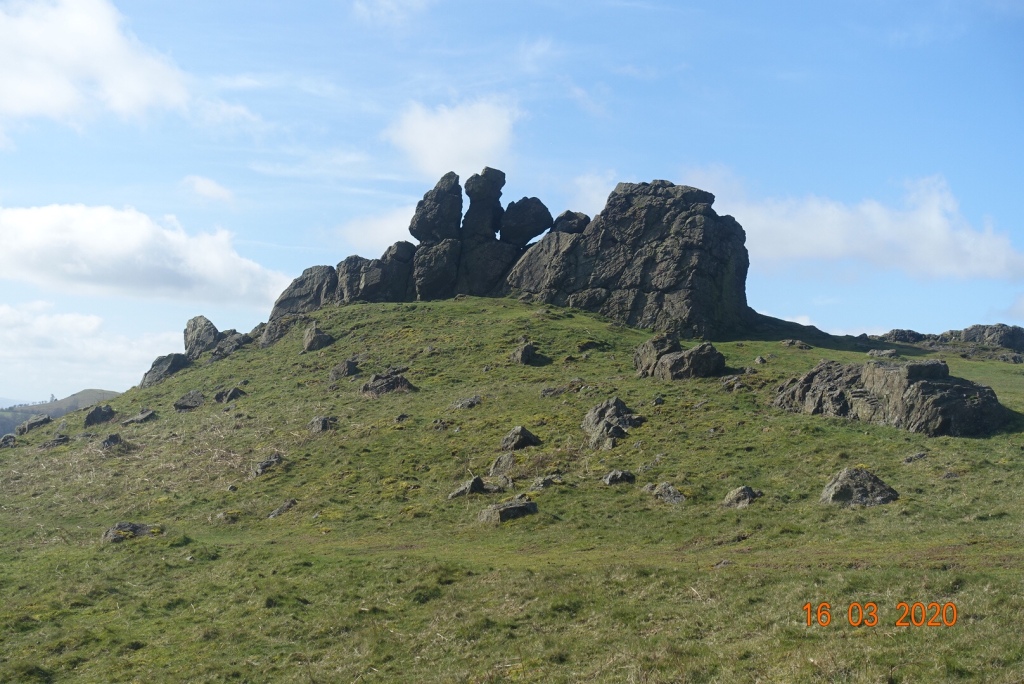
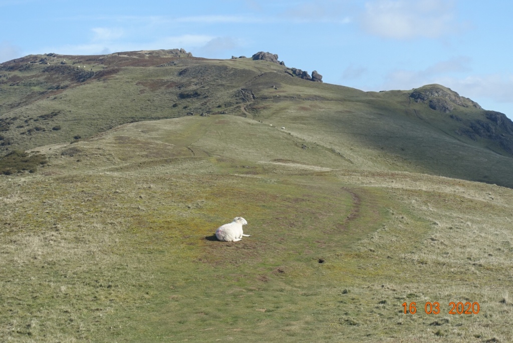
Called The Three Fingers?The view towards Church StrettonTowards the top A sheep presides over its kingdomThe view from the top to the south
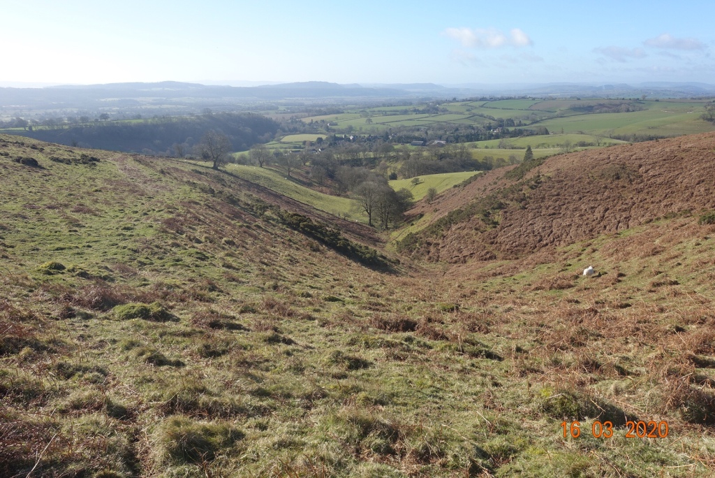
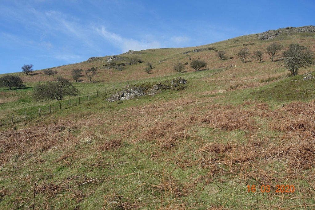
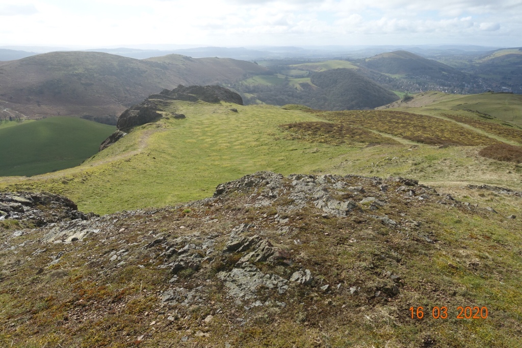
Unfortunately, it is all downhill from this point, and quite steeply too. I would recommend walking poles if you are slightly unsure of your balance. The descent is mostly on peat and heather, as opposed to the grit at the top, so if the path is worn or slippery you can walk on softer terrain which will give you more grip. As the descent eases it turns into a grassy track. You could carry on at this point and do the final hill in this series, but that was not in my plan.
The view downhill
I took a path to the right at the shoulder of the hill and followed this round the base of Caer Caradoc to Cwms Cottage, which is actually a ruin. At this point you are back on the former track. The walk continues for a couple of hundred metres west before turning south to go around another unnamed hill, with Cwms Plantation to the left. Once you reach the stile, the path follows a field boundary for about 10 minutes to a point where there is a conjunction of paths.
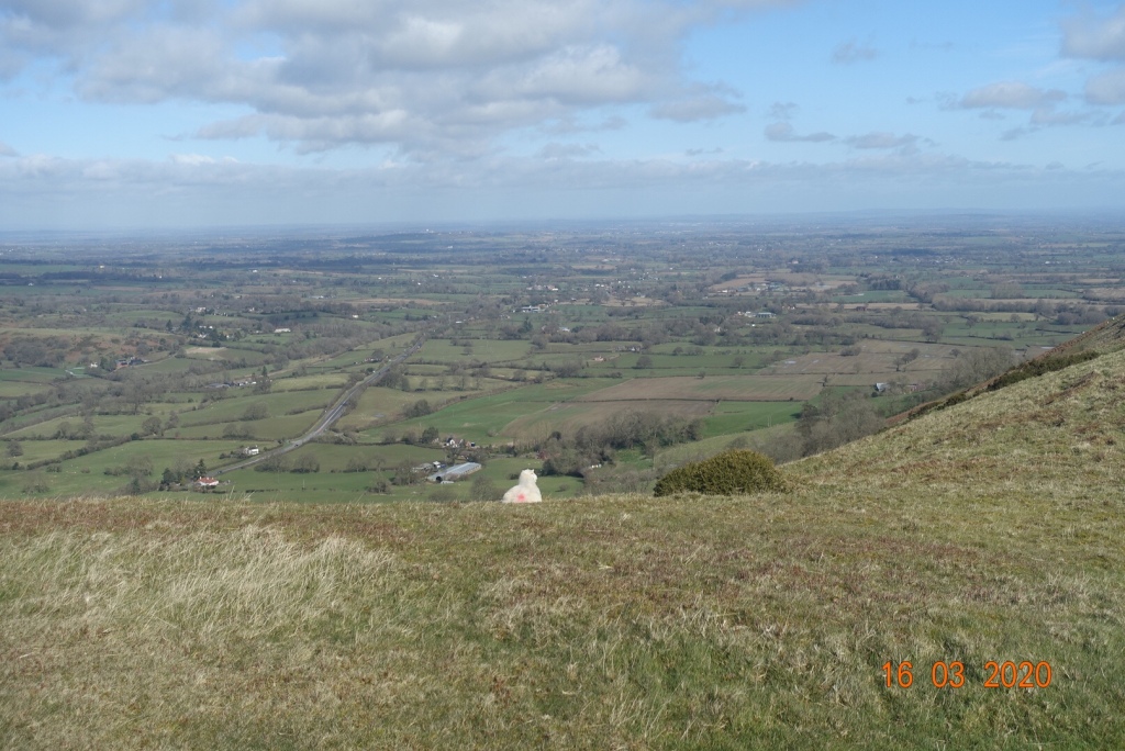
Theview northeast with the Wrekin in the distance
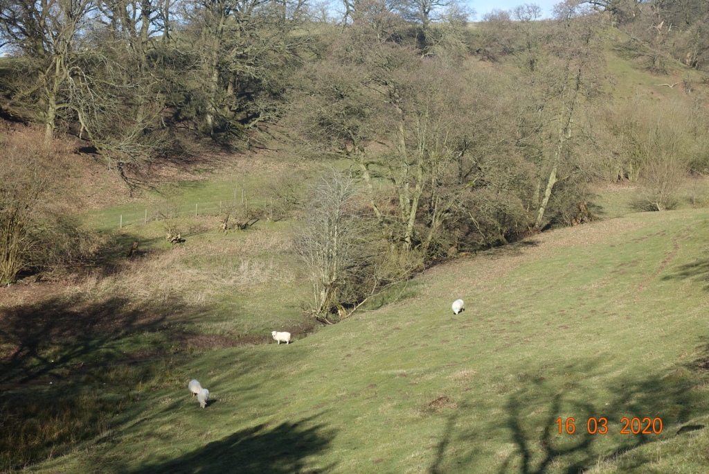
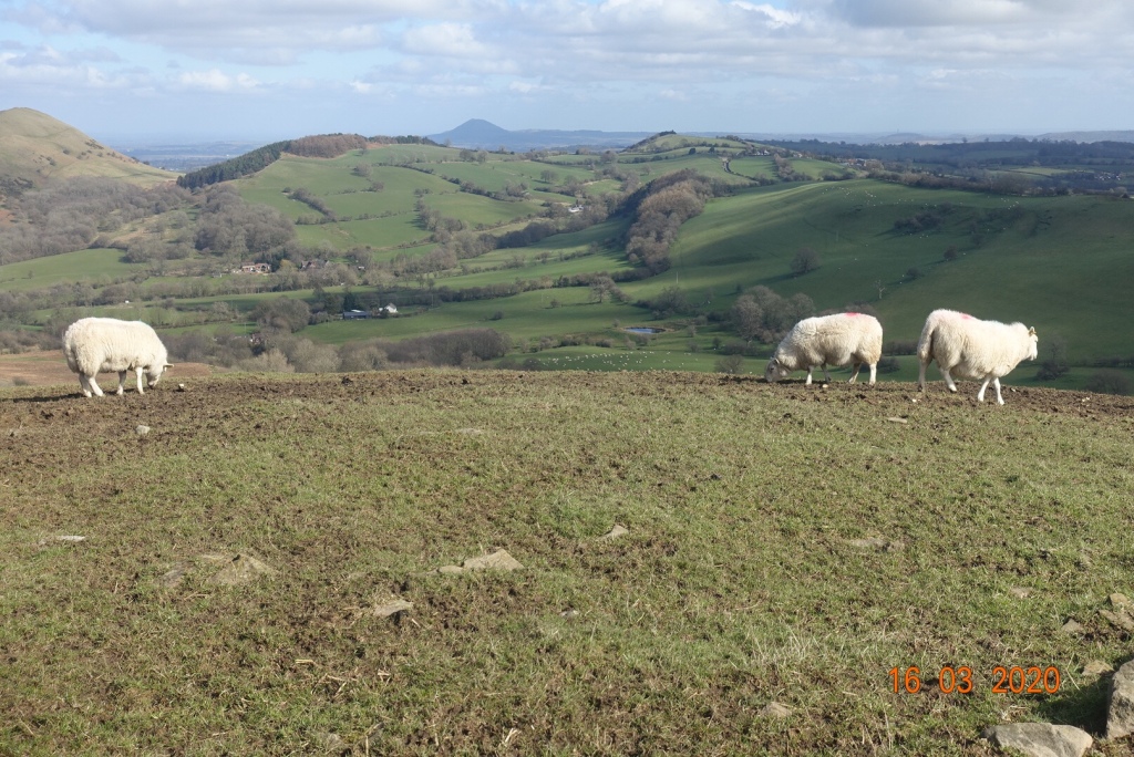
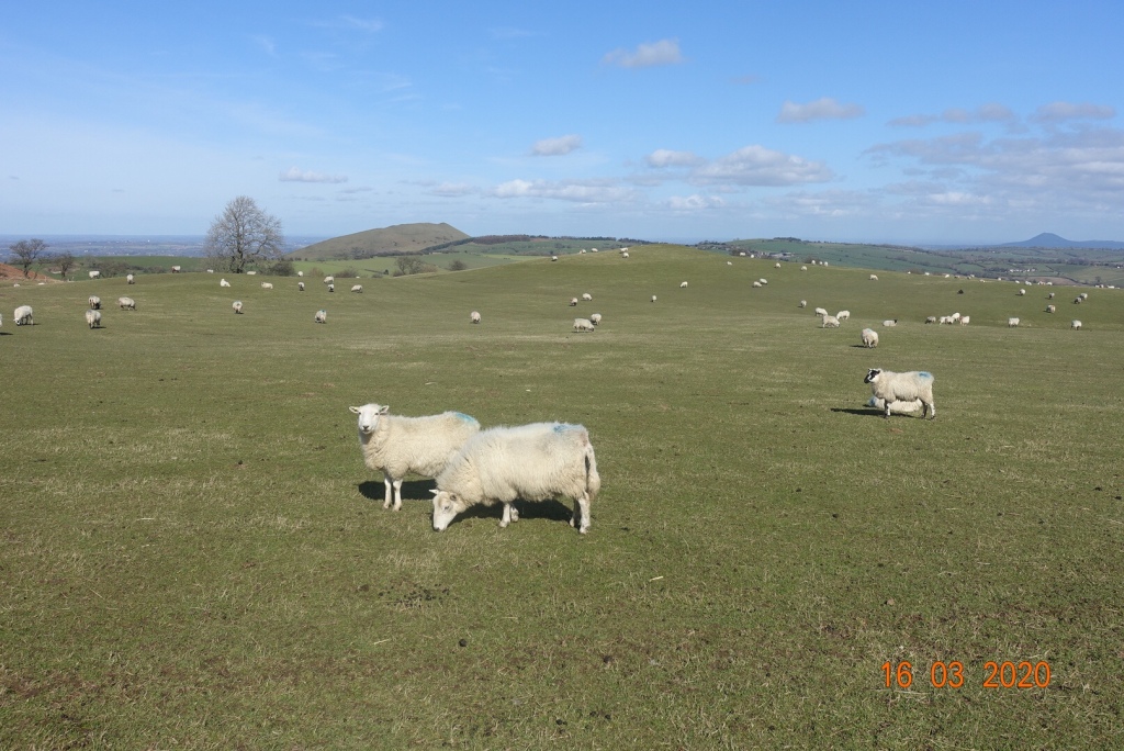
My route took me south and uphill again over but not over the top of Willstone Hill, across an area called Battle Stones. My path then continued over lovely sheep filled grassy meadows and took me down to Middle Hill, where I expected to walk through a farm and continue.
Sheep-filled meadows
However, it was marked private and no access. I do apologise but I climbed over the fence because the recognised footpath appeared to continue straight on. However, I would not recommend this. I saw no-one but I heard loads of dogs that were clearly aroused by my presence. They were contained in sheds and not visible, but it was a little alarming.
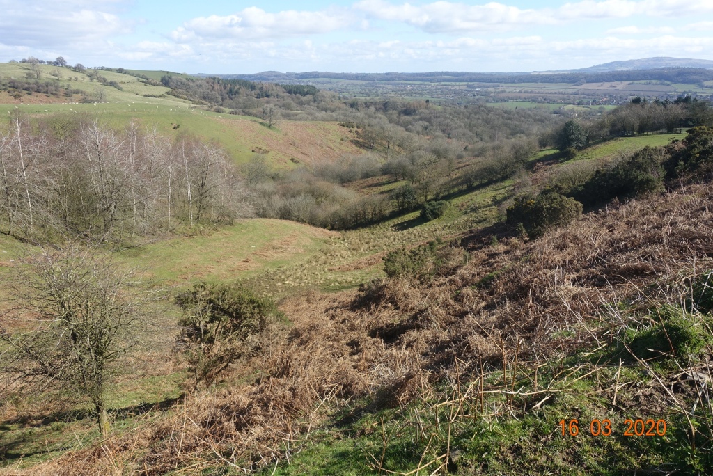
View from the track
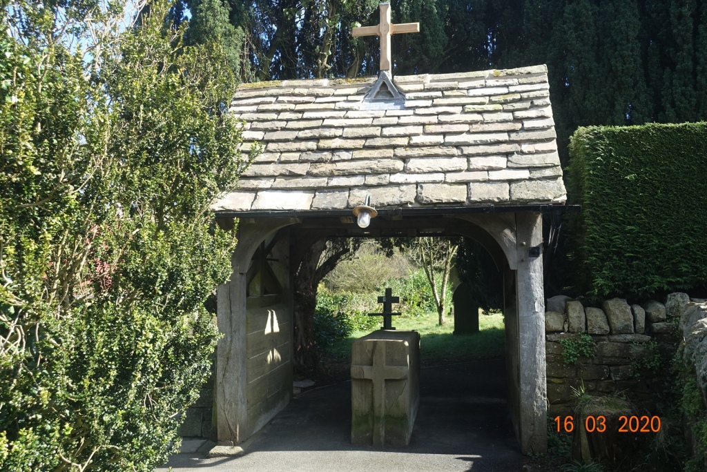
There is an alternative route, so don’t go down to Middle Hill but go to Cardington Hut and follow other waymarked routes. It will add on another mile, but you can actually start this whole walk the far side of Hope Bowdler, so it would even out. As for me I continued on the farm track. Once on the farm track there is another route via Greystones which takes you down to the main road. Either way, all paths lead to the main road and from there it is simple walk on a grassy verge back to Hope Bowdler.If you get the chance to visit St Andrews in Hope Bowdler it has the feel of centuries of worship and activity. It is only a small church, but it is very special, with an avenue of enormous yew trees leading you to the church entrance, and a lytchgate that still has the stone coffin stand in its entrance.
The lytchgate of St Andrews
This was a really super walk. It took about 4 and a quarter hours; 8 miles with 1889 ft of ascent and 1922 ft of descent.
Postscript, 22nd March 2020: Sadly, I had barely written this post when news came through that because of the coronavirus, anyone returning to the Isle of Man after 23.59 on Tuesday (the next day) would have to self isolate for 10 days. I took the rapid decision to get the 2.15am ferry and return to the Isle of Man, so after a hurried evening dinner with HF, I packed my car and shot off up the motorway.
On arriving home, I decided to self-isolate for 7 days in any case, so that is what I have been doing these last six days. Thankfully, I do not have any symptoms so I hope to scale up to the social distancing only stage from tomorrow. Our IOM govt has decreed that as long as we are sensible we can take ourselves for solitary walks, so I will try and fit a few in while most other aspects of life have been put on hold.
The hardest decision to be made each day is usually what to pick from the vast array of food for the packed lunch, closely followed by ‘which walk shall I do today’.
Given that my muscles are not great right now, and can be very painful on exertion, it was a fairly easy decision. Usually I would opt for the longest walk, especially if there is ridge walking involved, but I decided that 8 miles and just over 1000ft of ascent would be sufficient. It is so easy when you are younger to take your health for granted and it is so hard when your health starts to fail and you have to pace yourself and look longingly at ridges and scrambles rather than actually do them.
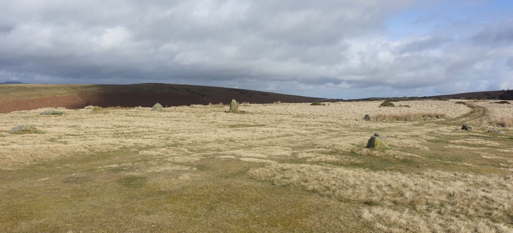
The day began with a coach journey of 40 minutes to our drop off point in the middle of nowhere, nowhere being just north of Corndon Hill at 344 metres. We followed an easy path over grassy knolls to Michaels Fold Stone circle, which is less impressive in practice than it sounds on paper. Makes you think a farmer so named it for his sheep. It was lovely up here, with wide expanses of moorland.
Michael’s Fold Stone Circle
From here we ventured south on very very muddy tracks to a place called White Grit. We followed a path taking us through Squiver farm up on to the very lovely Milk Hill, veering left of Mucklewick Hill – what wonderfully descriptive names they have in this part of Shropshire, though we may have been in Wales at this point. We continued to the foot of Grit Hill befor traipsing over boggy meadow to a spot called THE BOG. I write it in capitals as that is how it appears on the map.
Here there is a disused mine and a closed visitor centre, but there were benches where we could have our lunch. There was even old machinery showing how they transferred the rock from one end of the hills to another using a rope pulley system.
We had views of the Stiperstones from here, beguilingly in the near distance but just out of reach. We contoured around the lower regions and at a height of 430 metres we started our ascent to the Stiperstones ridge; we walked northwards along the ridge for a few hundred metres. It felt like more as it was very uneven, meaning that each step had to be carefully negotiated. This was our highest point of the day at roughly 490 metres. The views were tremendous in all directions, and we could see the foothills of Snowdonia in one direction, and the Wrekin in another.
The ever present Corndon Hill. We started to the far right of this then skirted left beneath it through fields on very muddy ground until we reached higher elevations. This area has a lot of undulating shale layers (the Mytton flags) creating clay soils, with discontinuous layers of volcanic rock. The hill itself is an intrusion of volcanic dolerite, as opposed to the Stiperstones quartzite, most likely laid down on a beach or in a water environment.
We descended through a narrow valley between Perkins Beach and Green Hill. This had a couple of steep and rocky sections but were easily passable with care. This section had an entirely different feel to anything we had encountered the rest of the day.
On reaching the road, it was just a hop, a skip and a jump to the village of Stiperstones and the village pub, which had a welcoming roaring fire, an old fashioned traditional pub, where you could imagine the locals sitting around sipping their pints and exchanging stories.
The whole country may be in disarray thanks to the Coronavirus, but where I am right now, no-one would ever know.
I was in two minds whether to continue with my planned holiday to the UK, but given that everything was still going ahead, i.e. boats, planes and trains, well not so much planes with the collapse of Flybe, I resolved to proceed as planned.
Well, not entirely as planned as I was booked on a Flybe flight, which then became as expensive alteration to my plans as I was obliged to use the ferry costing me £267.50 for me and the car, with a seat and WiFi being extra.
The journey was actually very pleasant – a smooth sailing sat amongst a crowd of netball and hockey players on their way to play in Lancashire. Travel down from Heysham on the M6 and A49 was uneventful and at least I wouldn’t be on a crowded train of potential virus sufferers.
I was especially thankful to be in the car when I arrived at picturesque Church Stretton, as Longmynd House is positioned up a steepish hill, which would not have been fun to walk with a suitcase and umpteen pairs of walking boots.
I had come very well prepared given that Shropshire has had such rains and floods in recent weeks, so I doubted that one pair of boots would be enough, and given that I am a messy walker, I would also need a range of other outerwear too. And having the car meant that I could throw in anything I like, which was a luxury I rarely encounter as I usually travel light.
The HF house is large, with a fantastic lounge offering panoramic views of Caer Caradoc and its range of soft topped grassy hills. I was suitably impressed with its wonderful location. I was eagerly greeted by one of the walks leaders, and the manager and team who preside over the house were very friendly and obliging so it was all very promising.
The evening was spent eating and drinking – there is always a lot of food at HF holidays, and the walks leaders introduced themselves and their walks for the following day. Not a mention of any type of virus so clearly it doesn’t exist, not here at least.
It was a good start to the holiday and the other guests were very friendly, so I knew I was in for a good week’s holiday.
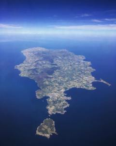
I don’t know about you, but I feel alive when I am outdoors, and what can be better than spending time walking around the beautiful Isle of Man. There is such a variety of walks, from strolls along the beach, along forgotten railway trails, down the (often steep) wooded glens with secret waterfalls tucked inside, across the windswept moors, or over the switchback hills. I won’t call them mountains as we only have the one over 2,000ft and that is Snaefell. All this in an island 32 miles long and 14 miles wide at best.
The purpose of this blog is to share with you some of the many and varied walks I undertake. I aim for one ‘long’ walk per week, long being a minimum of 6 miles, which isn’t really very long, but it can be up to 10 or 12 miles if I have the time. If I remember to set my Garmin, I record the route which I will post with photos taken en route on my mobile. More often I do shorter daily walks between 3-5 miles. I am fortunate in that I am spoiled for choice of route where I live, so I never get bored.
I usually manage the recommended 10,000 steps minimum per day (5 miles) and of course most hiking involves a degree of ascent, so quite often I add to my intensity minutes for the week. Given this helps the bones, muscles, heart and lungs to stay strong and as a by-product keeps the weight off, it is also a healthy hobby. On a planned longer walk I often aim for a brisk walk for the first hour with odd stops to take in the scenery and then I take the rest in a more relaxed manner.
Walking at any speed is always better than sitting on your bum, but casual and intermittent walking doesn’t really have much of a health benefit, although it is good for the soul. For health benefits you need to feel you have done it, and exploring your local countryside is a great way to do it!
So, to get started on the next page, I will shortly upload details of my walk on 7th August 2018.