Austria Day 4: Zell am See

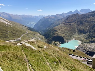
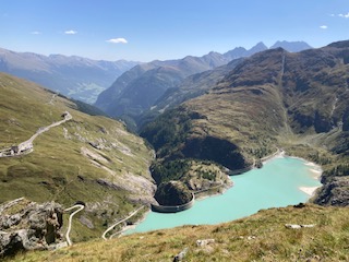
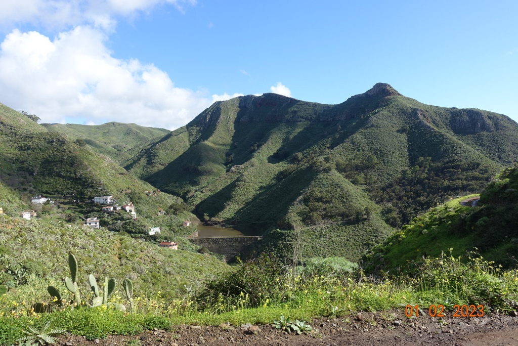
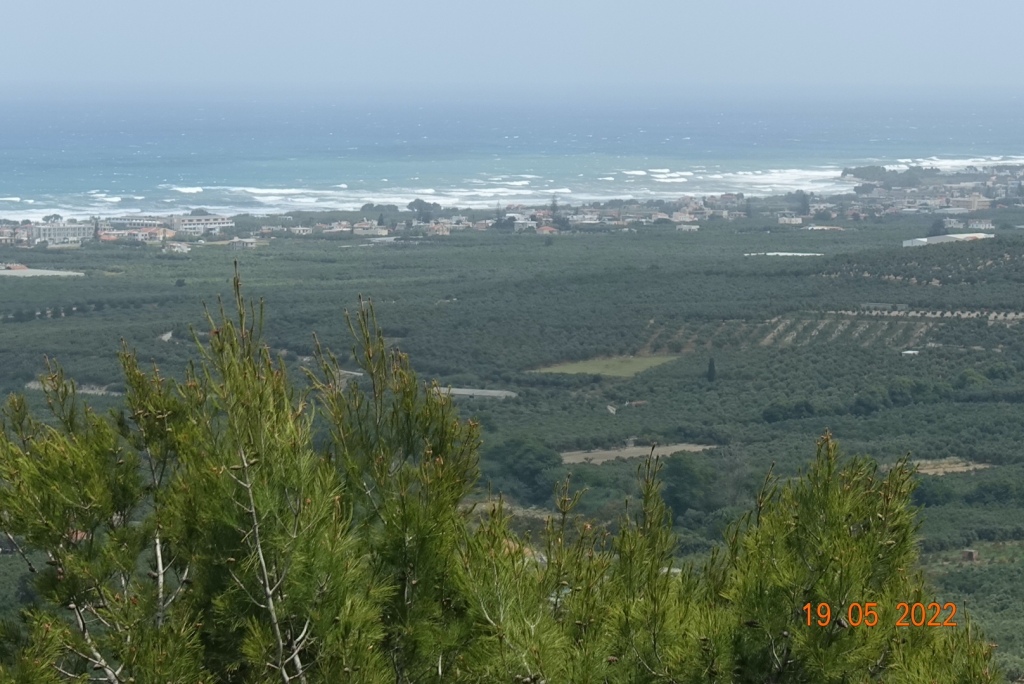
The day had a promising start, with sunshine, after a dramatic storm overnight with thunder and lightning that almost burst a few eardrums. We set off from Sankt Johann (nicely pronounced by the operator at the railway station) for our 45 mins journey to Zell am See. This is a most attractive high level ride for much of its route, meaning you have excellent views of the mountains and valleys. It moves quietly through one valley to another. There is no indication of a lake until you reach it – it comes as something of a delightful surprise. Indeed, if you travel by road, you can avoid seeing it at all!

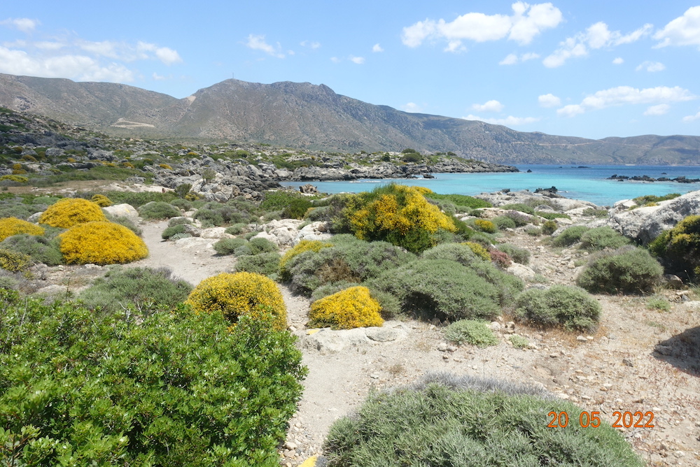
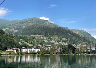
Zell am See has a calm and warming peacefulness. It is as if the surrounding mountains engulf and protect you. The lake is not huge, just 4 km long and 1 km wide, and 68 metres deep. It is a healthy place and the lake water good enough to drink, if you dare to try it. There is a footpath and a separate cycle path around the lake and plenty of places to stop for refreshments or to simply enjoy the magnificent views. At various points in the path are areas sheltered with trees and other places for children to play, all kinds of sculptures dotted around and water sports in abundance.

We did our own version of a watersport by taking a ride on the boat. This was enjoyable but at the same time unnecessary as you can see everything you want to see from beside the lake. However, the skyline was telling its own story. To the north, with its slightly lower mountains the sky was blue with puffy white clouds. To the south the clouds were grey and gathering and had a sense of foreboding; rain was clearly not too far away. For now though, it was bright if not hot sun, and warm enough to entice one into a lager.

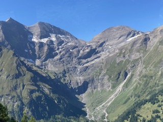
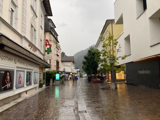
It was then time to explore the town itself, which is fairly small but even so has over 10,000 inhabitants. It also has an ancient history, as far back as the Bronze Age, and it was a trading post in more recent centuries. Learning about its past will have to wait until I have a chance to revisit this area. There are cable cars up to its central mountain, the Schmittenhohe, itself standing impressively at 1965 metres. From here, you are able to see over 30, yes 30 mountains over 3000 metres high, including the Grossglockner that we visited a couple of days ago.

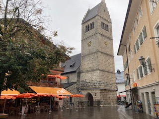
It was at this point that the heavens opened, and they weren’t even kind enough to give us much warning. I went in a shop in the dry and came out to a torrent of water flowing down the street – well, maybe not a torrent but you get my drift. They are clearly used to frequent downpours as the cobbled streets all have drainage channels that work very effectively, which is more than can be said for some inconsiderate drivers who soaked me as they sped past! Time for some shopping – I had needed to buy some new trainers and this was the perfect opportunity, and I found the best shoe shop I have been in for many a year. The lady actually wanted to help me, had some really good knowledge and as a result I am now the owner of a new pair of goretex shoes. She insisted I wear them straight away given the inclement weather, so my shoes and I went to look at the church in the main square, with its 15th century tower. As you look down the side of the church, it feels as if this is the only remnant of a bygone age, being surrounded by more modern buildings, but I suspect there are various gems to be discovered hidden away in the town.

It was then time to make my way to the Bahnhof for the return journey. The waiting room had one last surprise for us – exceedingly comfortable and colourful seating. Well done to the designer – compare this with the uncomfortable slanting metal seats we have in the UK and islands bus stops. Once on the train, I really wanted to see where the lake must spill into the surrounding plains but I didn’t detect any outlet. I have since learnt that the lake used to be much larger, reaching as far as Salzach, and much of the northern end has been drained, although there are still swamp areas in places.

By now the rains were eradicating any fine views of the mountains, but no matter. It is good to see landscapes in all their various moods and colours. Tomorrow, we visit Salzburg and we will have a guided walking tour, and this probably whet the appetite for future visits as I am sure we will not be able to see all we want to see in half a day.

Austria Day 3: Schleier Wasserfall, St Johann in Tyrol

This turned out to be the longest and hardest walk I have done in years. I was expecting it to be 10 miles and about 1600ft of ascent but in reality both were exceeded.

I started out at 8.30am with the intention of finishing the walk between 2-3pm and then taking the Gondola up one or other mountain. It was a warm day and the sun glistened on the river as I walked beside it up to Rettenbach. This lies in a plateau and the surrounding mountains stick out as a fine backdrop every way you turn. The only thing to spoil it at all was the sound of the traffic on the main road.

I reached Rettenbach easily and started looking for the footpaths that would lead uphill. In so doing, I passed a woodturner’s premises with the aptly named business title of Holtzwurm. Outside his premises he displayed some of his wares and fine specimens they were too as you can see in the photo below. Just past his domain was the first waysign to the Schleier Falls and I followed this path a short distance until it turned into a different sign saying Wanderweg, which usually means a contouring path circling an area. Look as I might for the path I wanted and I thought I had found it until this petered out. I made the classic error of not turning back immediately and got myself into real hot water when there was no clear path forward or back, just loads of vegetation and trees. Oops! I managed not to panic, and decided that if I keep the ravine to my right and the sun just to my left, I should ultimately return approximately to where I had started. These navigation skills supported me well, along with some odd black and white posts that I thought must lead somewhere, and after about 40 mins of traipsing aimlessly in the forest I found the original track, and just kept going, even if I was reasonably sure it was not the path I had originally wanted. Phew! I could breathe again.

I eventually I came to a path that did suggest it was going in the right direction and I followed this very successfully, passing lumberjacks clearing some of the forest and an old man resting on a log.

There are many twists and turns and false tracks to avoid on this walk. I did have a landscape map of the footpaths in the area but it wasn’t accurate. Some paths are unmarked on the ground, other paths are named but do not appear on the map, so whether you find your route successfully is rather hit and miss for the tourist. It is all heavily wooded, with no views as you make your way uphill. That is not to say it is unattractive, but it is unrelenting. There are also sections with steep drops and narrow paths, so not for the faint hearted.

By luck rather than judgement I seemed to find myself on the track I had intended, but what I didn’t know was where it would lead. There is an area called Debils Ofen, which I assume means Devil’s Oven, which is a series of caverns at the base of a massive rockface. The footpath actually passes through these, so I imagine when deluges come in winter this route will be entirely cut off. There were tree trunks and branches strewn along its course, evidence of previous activity.

Beyond this, the path makes its way annoying downhill, when you know that you have to go uphill, and sure enough just when you can hear the rush of water indicating you are getting near the falls, the path diverts uphill. There is a small summit and you can feel open space beyond, and I could hear voices chattering and laughing, so my sense of excitement grew. Be careful though not to get too excited as the path down to the base of the falls is rocky, with some large, and some small stones. Once your eyes adjust you can see the water cascading over the overhanging edge, looking rather like a shower curtain. There are other smaller falls, which no doubt become raging bulls in winter. I stopped temporarily under once such fall and washed my fevered brow. It was another very hot day, and for once I had felt the effects of the high altitude, so I took care to take my time, monitor my breathing and get back on an even keel before continuing.

It is much more interesting than it appears here in the photos and it is a very restful place.

The path down is a great deal easier than the path up, mostly on a fairly wide track. At the start, it is clear that my way down was most people’s way up as the stones were shiny and it would be easy to slip. Again, there are few views on the way down. The never ending tree lines are relieved in places by the children’s activity areas, which have been very cleverly designed.

Once back on level ground I decided to take the easiest road route back to St Johann. Having already done 11 miles, I didn’t want any false turns now and wanted to get back.

My Garmin watch recorded my route, which bears no resemblance at all to the paths on the tourist map I was given. I would recommend buying the Austrian equivalent of one of our OS maps or visiting the tourist information to get an up to date map and guide for any walk you intend to do. And make allowances for the high altitude, as it is relentlessly uphill for 7 miles.

Distance: 14 miles; Ascent 1988 ft; Descent 1949ft; Minimum Elevation 2224 ft; Maximum Elevation 3817 ft.

Austria Day 2 – Grossglockner

This was not a walking day, but an exceptional day for views as the coach took us higher and higher to the very apex of Austria – the Grossglockner. The images speak for themselves, and although I could name ridges and mountains I doubt if you would care much. The glaciers have retreated enormously since I was last there in the 1960s. I remember having a snowball fight with my peers in this location, but there was not a drop of snow to be seen below the glacier level this year. There are numerous notice boards dotted around the visitor sites, explaining that the process of deglaciation is not uncommon in the vicinity if you look back over the aeons. Nonetheless the rate of change is quite remarkable as you will see from the photos.

and from former days:

After this, we travelled to the beautiful alpine village of Heilingenblut. This traditional village has an iconic church and tremendous views down the valley, but little else for the passing tourist unless you have time in your hands, in which case you could visit the waterfalls or amble along the valley. The church graveyard was beautifully maintained with flowers in every single grave and with photos of the departed in each one, enjoying the afterlife as in life, with the glacier in the background.

On this journey, I found it quite remarkable that where the glaciers would have combined to be a great force to be reckoned with, where the dams now exist across their exit down the mountain, there is only the merest sliver of land through which all the water would have had to travel when the snow melted. I imagine this must have caused catastrophic floods during its ancient history.

There were also some lovely alpine flowers including masses of purple gentian and a hapless butterfly feeding on a plant yet to be named.

Tomorrow I am planning a walk on my own again, after a trip up the Gondola to the top of the local mountain.

Austria – Day 1: Eifersbacher Falls and St Johann

You were right. Even though this is a Great Rail holiday I would have to do my own walks. A holiday is not a holiday without stretching the legs, for me at least. To be fair, today was the ‘off’ day. Looking at a map I noticed that the Eifersbachers Falls were within walking distance of the hotel in St. Johann.

The walk begins with a stroll through the very attractive town of St Johann. I need time to explore this when everything is open, as today was Sunday. Crossing the bridge, the path runs alongside the river for about a mile or so. It is very open here, so you get the full effect of the sun. Just as you pass the airport, well not so much an airport as an aerodrome for small aircraft, you cross back over the bridge to join the main road. Don’t take the side road as this will take you down a blind alley.

Follow the road to the left for about 200 hundred metres, then the path is shown on the yellow waysign to the right. This is a delightful path, leading through the forest, with not too strenuous a gradient, until you reach The Eifersbacher Falls. These are tremendous with two or three separate falls, even at this time of year when there has been little rain. There is clearly a separate waterfall in winter too, but this was dried up now. You do need to be prepared for a very steep uphill section of about 300-400ft, way above the top of the waterfall. There is no alternative route unless you retrace your steps. However, the climb is worth it. Once at the top of this path, take a left, again traversing uphill, until you reach the Hornblicksee. This is a lovely lake, with loads of places to sit to enjoy the view all the way down the valley and into the surrounding hills.

There is a choice of paths from here. Very high, high or low. I took the high path that goes across the meadows underneath the cable car and ski runs down to a pension called Pointenhof. The views from here are ‘disappointing’ compared with previous views, but the beer was very welcome. Ironically, the hotel had arranged breakfast for us here earlier in the day, and that too was disappointing.

There aren’t many routes down to St Johann from here. I followed the main road downhill most of the way, as the one place I had thought of a change of direction was not marked as a footpath off the road. Instead, a few bends before you reach the cable car station is the most delightful walk through a wood that comes up right next to the cable car station. It has play things for children, and plenty of attractive seating area, so worth a visit on its own. From here, it was just a short walk back to the Hotel Park, and a nice shower after the very hot day.

Distance: 7.5 miles; Ascent 1650ft ; descent 1365 ft. Minimum elevation 2,234 ft; Maximum elevation 3598 ft.

Tenerife 28 Jan – 4 Feb 2023

I was so looking forward to my holiday. I had been in England looking at areas in Derbyshire where I might move back to in the future, and now I was in my way to Tenerife for a week’s holiday. I have never visited this island, although I have been to La Palma, which I very much enjoyed.

It could have started better. The Canaries are a place for winter holidays and although I didn’t expect really hot weather I didn’t expect as much rain, or mud, or for it to be as cool. I was also expecting it to be prettier, but my first encounter with it was on a very boring motorway in the south on which we travelled for 40 mins. The scenery was not captivating either, but I reassured myself that HF would not offer a holiday in a destination devoid of attractive scenery and good hiking countryside.

I was also somewhat dismayed to discover that La Laguna was a fair sized town, almost adjoined to Santa Cruz. The hotel Nivaria is situated in one of the few tree-lined squares in the town. It is an imposing building with a large entrance hall with comfy seating. The rooms are spacious and the beds comfortable. The food was excellent and always presented with a friendly smile. What about the walks you ask? This was a week of two halves, where after the first few days I could easily have packed my bags and gone home, but from Wednesday onwards the walks did improve.

The first day, the guides (as opposed to HF leaders) changed the planned walk due to bad weather, which is totally understandable. Instead they took us to the Roques de Garcia that are imposing rock formations on the western side of Teide, and the sun shone all day. We could see the mist just a few hundred metres below us, and we could see this was a good decision. However, much as it was a beautiful walk with amazing views, it was extremely short, just 3 miles with, if I remember rightly, less than 300 ft of ascent (less than going up to Bradda Head) and about 1200 feet of descent. The guides were incredibly knowledgeable and we learned a great deal and had an unforgettable experience crawling on our bums through an former underground lava tunnel, which was great fun. But, it was too short, and I must admit I felt short-changed, especially as this was meant to be the harder walk.

I didn’t walk with them Day 2 and instead got my bearings walking around the town, a gentle day in preparation for more extensive and more arduous walking the next day, only this walk too was changed to a most forgettable beach walk. We were not given detailed briefings or shown examples of the terrain or maps which would allow us to judge the suitability of the walk, but I was already worked out this was not going to be a great walk, so I packed my sketching set in anticipation of needing something ‘extra’. Our guide again provided interesting geological and historical facts, but as we neared our destination I decided to stop and do some sketching, even though there was little of interest to sketch. I am glad I did, as the group finished their walk by 12.30pm and had a 90 mins wait for the other group. To make matters worse we then had to wait a further 45 mins as the longer party (who had only done an extra 2 miles of beach walking) had been promised that they could get lunch when they arrived. I was literally hopping mad at this point, as this was meant to be a walking holiday not a sightseeing tour. The photos below make it look nicer than it really was!

The next day was the off day when guests do their own thing. I had asked one of the guides about local walks, so off I went in search of an adventure. The route started from the hotel with a short walk through the town. Crossing over a small river, the ascent on the eastern side of La Laguna began. It is something of a pull-up, but with a few small rests to gets my breath and admire the view I was soon at the true starting point amongst the dramatic hills. My tracker that we had spent some time getting to work, worked, and then didn’t work, so I looked at the hills and decided my route, bearing in mind I was looking for scenic views rather than views of the nearby conglomerations. I was not disappointed. The wide track turned into a narrow track just about where I thought my original route would have gone north. I was enjoying my new route and it took me around the back of one hill and provided distant views into the northern hills and a most delightful valley with a reservoir. I had no poles with me today, so extra care was needed over scrambly bits and muddy bits. I eventually ended up on a small road leading to the north side of this group of hills. Checking my map, I could see that the original route would be largely road walking from here, so I took the alternative path on to the very top of the hill. What a surprise I received up here, with oodles of yellow meadows in the foreground with the purple hills behind. There were masses of flowers throughout this route and it was almost like being in Austria. I dropped down the other side and contoured above my previous track with had surprising variety including some really rocky outcrops. The route was altogether 5 miles with 1300 ft of ascent and descent. Even so, I was back by lunchtime, and then I enjoyed a lazy afternoon reading and writing.

Thursday was a walk in the Teno mountains and by this time the guides had reverted to the original HF walks. Still not sure of my abilities I opted for the glorious easier walk, initially gently ascending through a green valley, then ascending more through a magical laurel forest before reaching the summit and a memorable ridge walk. The weather had improved and we had both distant views, views down the sea several thousand feet below and other views into the neighbouring ravines. I could have stayed up there for hours. The ridge walk was sadly only short and then the walk descended, contouring around hills to a viewpoint and cafe. This was a truly beautiful walk with great variety, 5.6 miles in length, 858 ft of ascent and 1483 ft of descent.

On the final day of walking I opted out for a variety of reasons. The easier walk, although attractive was not compelling as there was only a small amount of ascent and a lot of descent where the views would not change much. I was concerned that I might find the altitude too thin for me on the harder walk and I didn’t want to hold up other walkers. Plus, I wanted to go up Mount Teide. The cablecar doesn’t go all the way to the top, just as far as the cone where it changes colour, but I knew that I would be able to see views towards inside the crater of Pico Vieja, and to go to a volcanic island and not really experience a volcano would have been disappointing. I agreed with the guide that I would do this, followed by a walk to meet them at the end of the day. I am so glad I did this. The cablecar was very expensive at 38 Euros but it was worth it for the experience. I went from one viewpoint on the west to the other on the east. The weather was good but not fantastic, but I was treated to some steam emanating from Mount Teide as I returned to the cable car, reminding everyone that it may not be awake but it is still breathing.

From the cable car I had a 2 hour walk across the semi-barren landscape to the Parador beside the Roques de Garcia. The colours and distorted shapes of the volcanic rocks were interesting and varied as I twisted and turned around corners, and the vegetation looked even smaller against the magnificence of the huge mountains behind. In places, there were dried up areas that become wet with snowfall and form small lakes. It was a very pleasant and easy 5.3 miles of walking, basically flat, although my Garmin watch is telling me porkies and saying I climbed a few hundred feet. I did descend 853 ft, which seems realistic. It is impossible to gauge distances. I walked 2 miles south across the valley which from the road looked about half a mile, and when up on Teide, those summiting looked really tiny on the rocky top, whereas without any perspective it looks just a stones throw to the top.

So ended my holiday. I am back home now and it all seems very strange now, as if I have just woken from a dream, something that never happened but only occurred in my imagination. Perhaps you will get a sense of this from the last photo I took as the plane took off from Tenerife, with Mount Teide hiding in the sunset clouds.

Time away in Crete

Yes, I know it’s not the Isle of Man, but reluctantly I cannot do any walks at the moment as I have an ankle injury sustained while I was… in Crete, two weeks ago.

This was a walking holiday but I was not sure how much walking I could actually do, so on the spur of the moment I put a sketch pad in my suitcase along with my walking boots and off I trotted to Crete. I have been before, but not stayed on the western side. I had hoped to do the Samaria Gorge this time, at least that was my intention.

We stayed in a beautiful 4 star hotel miles from anywhere in a village called Spilia, a little distance from Chania. If I wanted to do any walks by myself this would necessitate a 32 mins walk each way to the nearest village to use public transport. But I am not complaining. The hotel was so relaxing, with two lovely swimming pools; the food was excellent and each room was completely individual and all scattered around the complex. It had originally been an olive pressing factory.

I did some walks with the group, alternating days, sometimes doing my own thing and yes, I did do some sketching, sometimes just 30 mins sketches and at other times adding in watercolour, but nothing taking more than 2hrs from start to finish. This was an absolute joy and has opened my eyes to painting ‘plein air’. I never want to have to paint anything from a photo again. Just give me an image and let me and my imagination paint the picture.

My highlights of the week are probably rather different from the rest of the walking group. The intrepid walkers did do the Samaria Gorge, but I and others opted for the Imbros Gorge, this being the shorter option and with the opportunity of a boat ride to otherwise inaccessible villages along the coast. I completed the Imbros Gorge in under two hours, then did a quick sketch of a village by the sea and then Loutro after the boat ride. The weather of course, was just wonderful, hot and sunny, but not too hot. Other than that, my favourite times were spent on my own, walking up the hill to the magnificent St John’s Cave at Spilia, seeking out other lesser known tiny chapels built into the rocks, and paying for a tour to Elafonisi beach on a day when nobody in their right mind would think of spending time on the beach as it was really windy, open and exposed! It looks idyllic on the photos but they are deceptive. It was extremely windy! But I loved it, and despite sand blowing all over my paints and painting, my water getting blown over time and time again, and the wind and sun drying out the paint as soon as it landed on the paper, I have a sketch painting that I positively like. It has life and vibrancy, not surprisingly rather more than was actually present on the day. The odd thing about Elafonisi is that the coastal footpath is certainly not flat and even. You have to walk through a boulder field, often clambering over rocks taller than me, but offering views of the most beautiful coastal nature reserve. The E4 footpath goes right round the island. Now that sounds like my kind of walking, at least in my mind. I would go back there again should I revisit Crete, but take a little more care as it was on the last stretch of this that I twisted my ankle and it still swells and bruises two weeks later if I walk on it.

The cave of St John’s at Spilia was a real bonus. I didn’t expect it to be so spectacular. It was huge, with lots of nooks and crannies, so I was able to sit there with the dog I acquired on the way up and just do an outline of the pillar cave. On returning to the hotel, I spent a couple of hours painting it from memory. It is so nice to have 5 sketches /paintings all in one sketchpad and I shall take this with me every time I go away to add others to my collection. Florence will be my next trip in the autumn – just two or three days, but time for my more experiences and sketching. I think a sketchbook will be more memorable than any photo I could take and when I am in my dotage I shall enjoy reminiscing about my time in Crete and other places I have visited.

The HF walking party were great fun. We all got on together so well, and there was a lot of laughter, eating and drinking, and until I did my ankle, we played table tennis too. Thank you to everyone who made my holiday so enjoyable. I shall try and put behind me the absolutely dreadful treatment we got from Easyjet when our flight to the IOM was cancelled having been half way round England before taking us back to Gatwick and totally abandoning all the passengers in the evening and not even providing any food or accommodation! To make matters worse, there were no flights for 3 days. As you would expect, I found an alternative and was back on our island the next day.

So I finish with a slideshow of photos to whet your appetite. Oh, and if you wish to try out the hotel it is called Spilia Village and you can find out more here: https://spiliavillage.gr/

Guernsey – final day 30/08/20

With only a morning left, I had my last opportunity to visit any local attractions, and as Little Chapel was less than two miles from my hotel at La Villette, this seemed the perfect choice for my final walk.

The interior of the island is much quieter than the main thoroughfares and Guernsey has many publicised ‘Routes Tranquilles‘, the equivalent of our Green Roads. I was able to make use of many of these, which I imagine were farm roads in years gone by.

You will recall that the island claims to have no hills. Of course, it is not entirely flat, and inland it has a regular pattern of small hills cut through by attractive streamlets. I walked 7 miles inland this morning, and even then I managed to climb over 809 ft, so you can see this is a surprisingly undulating island. The highest point on Guernsey appears to be Hautnez at 111 metres, which is near the airport. Many of the cliffs are of similar height.

But today was pure countryside and brown and white Guernsey cows, and tiny villages with magnificent buildings.

The Little Chapel is very beautiful. I was expecting just one area for worship but there were a number of small chapels, all equally beautifully adorned. Creating it must have been a real labour of love and I could imagine using it for personal worship. Somehow it doesn’t feel as if it ought to be a tourist attraction.

Having visited the chapel I went to the village of Les Vauxbelets and followed the route tranquille up to the Candie Road. I turned left as I had spied a walking path through woodland that interested me at Les Fauxquets. This was a pleasant walk, though the end of the path was unfortunately very muddy, making a mess of my new shoes.

I followed the Route des Talbots with the Talbot Valley on the right. It is very picturesque with some beautiful houses. I then took side routes, that lead to St Andrew church. From this point I followed more routes that were ‘tranquilles’ but unremarkable and I was soon back at Mouilpied, the small village close to La Villette. I was back in time for a lunchtime pint in the bar, and later on a cream tea to keep me going until I arrive back on the Isle of Man.


So what have I gleaned of Guernsey these last few days?

1) it has far too many people and cars

2) the coastline to the south and south east is magnificent walking country.

3) their number plates contain only numbers, usually 5 digits but I saw one today with only 4

4) they have a good bus service, but narrow lanes therefore all journeys are slow, and if you happen to be behind pedestrians or cyclists, very slow

5) they build very large walls around their properties in the main town

6) books are cheap. My copy of Les Contemplations cost £3.71.

7) the footpaths are good but many do not contain waymarker signs. The scaled map is very good.

8) their post boxes are blue and set into walls.

9) many of the villages have their own ‘abreveur’, pumps which provided water for the local villagers

10) although the village names and places look and sound as if they are french, the pronunciation is different, more anglicised

11) it has a lot of cows

12) it is inundated with reminders of its war time histories

13) I didn’t pass a single shop on any of my walks, except beach cafes and, naturally, in the metropolis that is St Peter Port

14) if walking the coastline, be prepared for hundreds of steps! Continue reading “Guernsey – final day 30/08/20”

Guernsey Day 4 – coastal walk 29/08/20

This was my last full day of walking, so I started out early from the hotel finding a new route down to Petit Bot Bay.

Others had already arrived by the time I got there, mostly children and their parents who I think were about to go kayaking. There was already one group in the water. There is a cafe here, but as it was not yet 10am it had not opened.

The climb onto the cliffs is fairly strenuous, with something like 160 steps. I tasked myself with counting them today. Over the full day, I think I climbed 800 steps as well as encountering the standard undulations. It is worth the climb as the views are terrific and you get a sense of accomplishment too.

The coast path goes inland to cross streams in a few places and the paths weren’t always easy to find. To make matters worse ( or better), the Guernsey National Trust has purchased various areas around the cliff path and there are numerous routes within these areas, should you decide to veer off the regular track to explore. On one such occasion around Les Corbieres I did not quite end up back on the right path and found myself on a path slightly more inland than intended. Not that it mattered. This was a fairly long walk anyway of between 9 and 10 miles and I was more interested in reaching my destination than being pedantic about which path I took. However, because of this detour I did not visit the German Observation Tower at the top of this post, though I saw it for many miles thereafter.

There are only two places on this section of the coast path where you can get drinks so make sure you take plenty with you in case they aren’t open. It hasn’t been very warm for late summer but even so my stocks of water were getting low towards the end and I was concerned about getting dehydrated. There is a cafe and a bus terminus at the end of this walk, so it is easy to replenish your stocks and get back to your starting point, although buses are only once a hour. I had thought of going to see Little Chapel as I had finished by 2pm, but there were no buses going to that area at all on a Saturday.

The paths look very similar to the walk I did the other day, so instead of describing the route, I will leave you with a gallery of photos of the walk. I must say, I think this south western point is prettier and quieter than the eastern side around St Peter Port, and the houses I saw were much less showy.

Tomorrow, I shall walk to Little Chapel and return to my hotel for afternoon tea before my mid afternoon pickup for the airport.

Overall distance: 9.17 miles; total ascent 1414 ft; total descent 1762 ft

Guernsey Day 2 – La Villette to St. Peter’s Port 27/08/20

I had been warned by the taxi driver that this is quite a strenuous walk with a lot of steps, so I knew what to expect.

I set out early in the morning and was on the cliffs shortly after 9am. I decided to miss out Icart point and start with a gentle route down to Saints Bay, following another gladed valley. I soon hit the coast path contouring around several small bays, including Bon Port to Jerbourg Point.

At Moulin Huet car park, be careful to follow the map and descend along the road. The path then takes you through some light woodland before you ascend once again on the open coast path. There are one or two ins and outs on this stretch giving some variety to the walk, but whenever you turn a corner, the views are splendid. Renoir created some of his masterpieces here and there are several information boards showing you the view he was capturing. Below is one such scene.

There are two viewpoints mentioned on the map on the Jerbourg peninsula and it is worth taking your time here. The close up view of Les Tas de Pois d’Amont (translates as Pea Stacks) which have been visible all the way around this large cove is magnificent. The path continues around the point to join a lane which leads to the Jerbourg hotel. If you have had enough of steps by this point you can while away your time in the hotel having a cream tea, and then catch the bus (no 81) which will take your on a tour of the island back to St Peters Port.

I do not say this lightly, as the next section begins with a lot of descent and more steps, in the sure knowledge that you will have to ascend the same amount before long. This is a kinder path and slightly more undulating than straight up and down and you get the first views of Helm and Sark and the Castle at St Peters Port.

I had set off in fine sunshine, and pleasantly warm. I was also aware of dark clouds looming over the land and I was forlornly hoping that I might escape rain. This was not to be, but thankfully there was some tree cover and I waited patiently for a gap to appear in the lashing rain before I continued. Patience was clearly not a virtue and was going to make no difference, so I set off again for Fermain Bay, where I could see a cafe beside the beach. It was just about noon and I had walked 6 miles. I enjoyed some warming cups of coffee, had a chat with a local who had been swimming and I think wished he hadn’t bothered and ate my packed lunch. The tide was almost in but it looks to be a lovely beach and on a nice day I bet the locals come down here.

There was a brief respite so I set off again, yes, you can guess it, uphill again through woodland at Ozanne Steps and past some houses that had the most scenic and uninterrupted views of the sea. Leaving that path, it takes you to the Clarence Battery at Les Terres Point, an outpost that has guarded St Peters Port for centuries. From there it was a steady descent along La Vallette into St Peters Port.

I didn’t spend much time here today. I wanted to get back to the hotel, dry off and catch up on some sleep! So I boarded the bus, which showed me the delights of the area and dropped me off outside my hotel – very convenient.

I don’t know how many steps there were altogether, but it must be hundreds as there were usually about 30-40 minimum on each ascent. The total distance was 8 miles, descent 1726ft and ascent 1427ft. This walk started with descent, and it is this combination that makes it a little tiring. But it is so rewarding, and if you have a fine day, I would recommend it.

The weather forecast for tomorrow is not great, so I am thinking of doing a hop on hop off bus tour to the other side of the island and maybe do a bit of shopping.

Continue reading “Guernsey Day 2 – La Villette to St. Peter’s Port 27/08/20”

Air-Bridge Guernsey – Arrival Day 26/08/20

What an eye-opener! From the sky Guernsey looked to be a highly populated possibly overcrowded little island. In the taxi, I was struck by the amount of traffic, but once I got to my hotel south of St Peter Port at La Villette, I discovered a different world, of long lost lanes, attractive stone cottages, cows(!) and a most magnificent coastline only a mile away.

From what I have seen in the few hours I have been here, this is an island that cares for itself and looks after itself. The houses in the villages are well maintained and look as if they follow tradition. There is evidence of many former farms dotted around and even the new houses are made to blend in with the natural stone of their predecessors.

Typical former farmhouse on Guernsey

When I arrived it took me a while to get my bearings as I thought the airport was near the main town, when in fact it was in completely the opposite direction. This being so, my first amble took me in a different direction from that where I wanted to go 🙂 Thankfully, my trusty Garmin watch knew where I was going, so I soon discovered my error. It would have been useful to find out where I was staying before I went on holiday, as I was guessing from the word ‘go’, and usually I am better prepared. On this occasion, I hadn’t given my short break a moment’s thought beforehand.


So here I was, an hour and half after arrival and three hours left before the restaurant closed. Time to explore. This time I went in the right direction and after a mile I was on the cliffs admiring the sea and shoreline. I couldn’t stop there, so after a cursory look at the map I decided to head westwards or if looking at the sea – to the right! The cliffs were so inviting – so inviting I would break into a hop and a skip or even a little jog every now and again. The sunlight was glinting behind the cliffs in front of me me and I made a mental note that this walk would be best undertaken left to right in the morning another time.

There are a number of ups and downs on this stretch of path but nothing too demanding. The paths are very well maintained and look natural (note IOM govt), and there are many sections with stone and sandy steps which are easy to traverse. The path reminded me very much of sections of the South West Coast Path which I did with my third son, Matthew, when he was a teenager.

The cliffs are interspersed with shady glens leading down to the little beaches. I am looking forward to exploring more over the next few days, but I know it will be over too soon.

I am trying to extend my holiday to 5 days. The hotel has room for me but the flights are fully booked, so I must make the most of my four days here.

Total distance: approx 3.5 miles, 489 ft of descent, 500ft of ascent.